Tropical Storm Chantal Enters the Eastern Caribbean
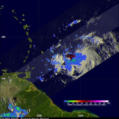
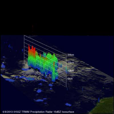
Since forming on the night (EDT) of 7 July 2013 in the tropical central Atlantic, Tropical Storm Chantal has continued to race westward at up to 29 mph (~46 kph) and has now entered the eastern Caribbean with sustained winds reported at 65 mph (~100 kph) by the National Hurricane Center. TRMM captured this latest image of Chantal at 02:37 UTC 9 July 2013 (10:37 pm EDT 8 July) as Chantal was approaching the Lesser Antilles. The image shows the horizontal distribution of rain intensity within Chantal. Rain rates in the center of the swath are from the TRMM Precipitation Radar (PR), and those in