COSME

TRMM Sees Cosme Peaking

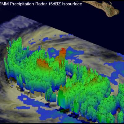
The TRMM satellite had a perfect view of hurricane Cosme when it was close to peak intensity. TRMM passed directly over head on June 25, at 2157 UTC (2:27 PM PDT). At that time hurricane Cosme was estimated to have winds of over 70kts (~80.5 mph). TRMM's Precipitation Radar (PR) saw very heavy rainfall in powerful storms on the southwest side of Cosme's eye. TRMM's 3-D Precipitation Radar (PR) data shows that Cosme had a ragged eye wall. The highest thunderstorm tops, reaching heights of about 13km (~8.1 miles), were found by TRMM PR to be located in the northeast side of the eye wall. Click

Tropical Storm COSME Becoming Stronger

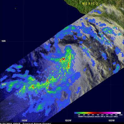
Tropical storm Cosme was illuminated by morning sunlight when the TRMM satellite flew over on June 24, 2013 at 1304 UTC (8:04 AM PDT). COSME had become much better organized since being upgraded to a tropical depression 24 hours earlier. A rainfall analysis derived from TRMM's Microwave Imager (TMI) and Precipitation (PR) data are shown overlaid on a visible/infrared image from TRMM's Visible and InfraRed Scanner (VIRS). TRMM PR found rain falling at a rate of over 113 mm/hr (~4.4 inches) just to the south of Cosme's center of circulation. TRMM's Precipitation Radar (PR) data were used to show