Cuba

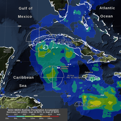
IMERG precipitation totals from Hurricane Ian
Hurricane Ian formed in the Caribbean Sea on Sept. 26, 2022. Ian intensified to Category 3 hurricane on the Saffir-Simpson scale by the time it made landfall in western Cuba early the next day. NASA's near real-time IMERG algorithm was used to estimate the precipitation from Ian during its formation and intensification. IMERG shows that Ian's largest rainfall accumulation so far, over 12 inches, occurred while it was only a tropical storm and not yet a hurricane. The National Hurricane Center provided an estimate of the distance that tropical storm-force winds extended from Ian's low-pressure
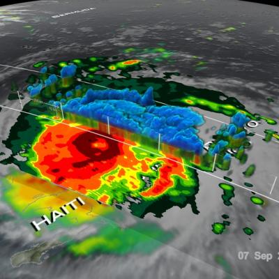
GPM Examines Hurricane Irma
The GPM core observatory satellite had an exceptional view of hurricane Irma's eye when it flew above it on September 5, 2017 at 12:52 PM AST (1652 UTC). This visualization shows a rainfall analysis that was derived from GPM's Microwave Imager (GMI) and Dual-Frequency Precipitation Radar (DPR) data. Irma was approaching the Leeward Islands with maximum sustained winds of about 178 mph (155 kts). This made Irma a dangerous category five hurricane on the Saffir-Simpson hurricane wind scale. Intense rainfall is shown within Irma's nearly circular eye. This 3-D cross-section through Irma's eye was...

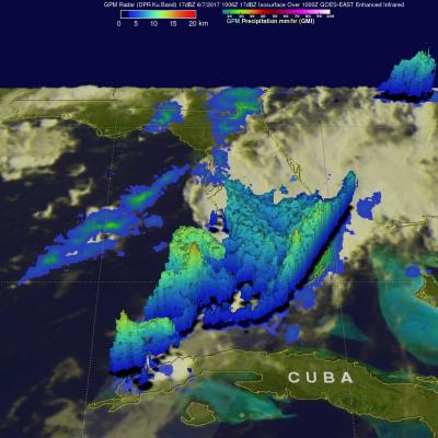
Extreme Florida Rainfall Examined With GPM

Extremely heavy rain has recently fallen over Florida. Over 19 inches (482 mm) of rain has fallen in southeastern Florida during the past seven days. Record rainfall has been reported in Fort Lauderdale and West Palm. This extreme rainfall has led to flooding and flight cancellations. The GPM core observatory satellite flew above southern Florida on Wednesday June 7, 2017 at 6:06 AM EDT ( 1006 UTC). Data collected by GPM's Microwave Imager (GMI) and Dual-Frequency Precipitation Radar (DPR) instruments revealed the intensity of rainfall within powerful storms that were drenching southern

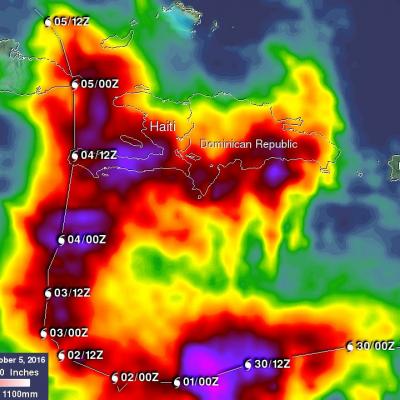
Matthew Brings Heavy Rains, Destruction to Parts of the Northern Caribbean

Matthew began as a fairly impressive tropical wave that emerged off of the coast of Africa on the 23rd of September but had to make its way all the way across the Central Atlantic before finally organizing into a tropical storm on the morning of the 28th while passing through the Windward Islands. Matthew then slowly but steadily intensified into a minimal hurricane by the early afternoon of the following day as it continued to track westward through the central eastern Caribbean. The next day, September 30th, Matthew underwent a period of rapid intensification; its winds increased in

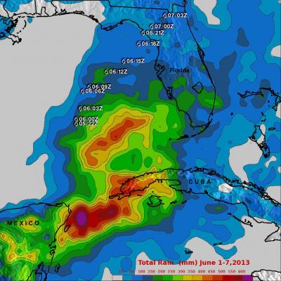
Andrea brings Heavy Rains to Cuba and parts of the US East Coast

Tropical Storm Andrea formed on the late afternoon of June 5th, 2013 from a trough of low pressure that had persisted for several days over the southeast Gulf of Mexico. This trough extended out over the Gulf from the Yucatan Peninsula and provided the focus for the development of showers and thunderstorms in the region, eventually leading to the formation of Tropical Storm Andrea. With its suite of passive microwave and active radar sensors, TRMM is ideally suited to measure rainfall from space. For increased coverage, TRMM is used to calibrate rainfall estimates from other additional