
GPM Examines Hurricane Irma
The GPM core observatory satellite had an exceptional view of hurricane Irma's eye when it flew above it on September 5, 2017 at 12:52 PM AST (1652 UTC). This visualization shows a rainfall analysis that was derived from GPM's Microwave Imager (GMI) and Dual-Frequency Precipitation Radar (DPR) data. Irma was approaching the Leeward Islands with maximum sustained winds of about 178 mph (155 kts). This made Irma a dangerous category five hurricane on the Saffir-Simpson hurricane wind scale. Intense rainfall is shown within Irma's nearly circular eye.
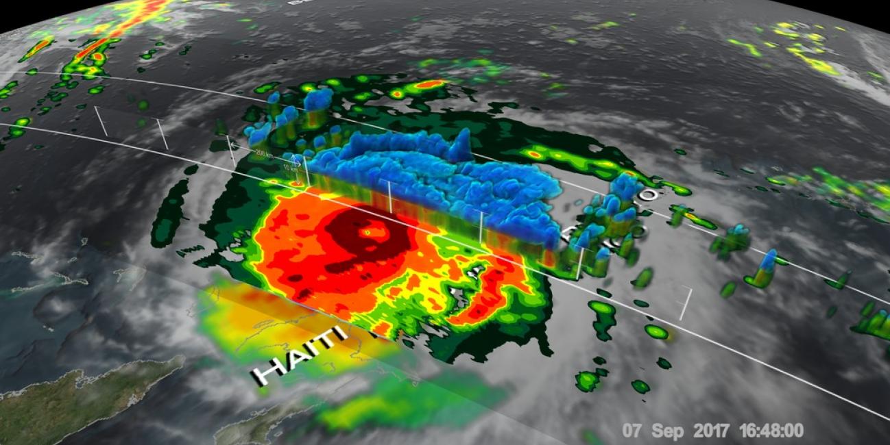
This 3-D cross-section through Irma's eye was constructed using GPM's radar (DPR Ku band) data. GPM's radar revealed that the heavy precipitation rotating around the eye was reaching altitudes greater than 7.75 miles (12.5 km). The tallest thunderstorms were found by GPM's radar in a feeder band that was located to the southwest of Irma's eye. These extreme storms were reaching heights of over 10.0 miles (16.2 km). Intense downpours in the eye wall were found to be returning radar reflectivity values of over 80dBZ to the GPM satellite.
Irma rapidly intensified on September 4-5 as it moved over very warm waters and into an environment will weak vertical wind shear (the change of winds with height). Irma maintained maximum winds of 185 mph for a day and a half, making it one of the longest-lived storms at this intensity. That intensity made it the strongest observed storm over the Atlantic Ocean (excluding the Gulf of Mexico and Caribbean). Irma’s rapid intensification was very similar to Hurricane Harvey's in the Gulf about 10 days earlier.