Guam

GPM Views Super Typhoon Maria Near Guam

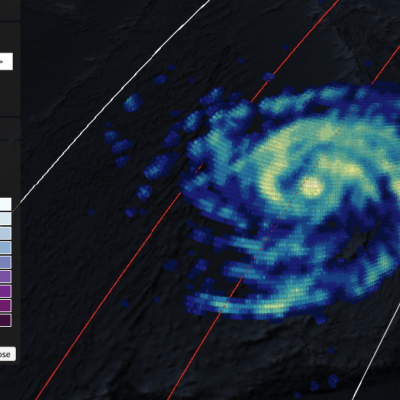
View full screen in STORM Event Viewer. Rapidly intensifying after its genesis near Guam, Super Typhoon Maria featured winds near 130 knots as it spiraled through the waters of the Western Pacific Ocean. The DPR scan indicates deep convection in several parts of the outer bands, with the most intense precipitation rates from GMI concentrated in the eyewall. Maria is expected to continue intensifying over the next three days, then weaken slightly as it crosses through the Ryukyu Islands, possible near Okinawa. The long range forecast has it making landfall in Northern China, possibly still as a

Typhoon Dolphin Weakening after Drenching Guam

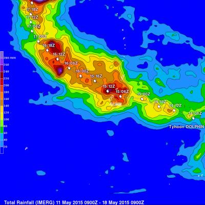
Typhoon Dolphin battered and drenched the islands of Guam and Rota as it passed over the channel between them last Saturday. Luckily for Guam, Dolphin's most powerful winds occurred after passing to the northwest of Guam. By May 16, 2015 Dolphin had winds estimated at 140 kts (161 mph) making it a category five super typhoon on the Saffir-Simpson hurricane wind scale. The GPM core observatory satellite flew above the weakening typhoon early this morning when winds had dropped to less than 100 kts (115 mph). GPM's Microwave Imager (GMI) found that Dolphin was dropping rain over the open waters

Typhoon Dolphin Brushes Guam

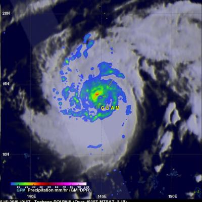
Typhoon Dolphin passed through the Northern Marianas today just to the north of Guam with sustained winds estimated at 95 knots (~109 mph) by the Joint Typhoon Warning Center. The center passed through the Rota Channel less than about 25 iles from the northern tip of Guam, close enough for the southern half of the eye wall to rake the northern part of the island with powerful winds. A wind gust of 106 mph was reported at Andersen Air Force Base located on the northeast corner of Guam. NASA's GPM Core observatory satellite captured this image of Dolphin just as the center was exiting the Rota

GPM Views Typhoon Dolphin Headed For Guam

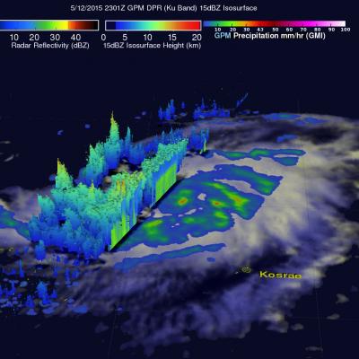
Typhoon Dolphin formed south of Pohnpei in the western Pacific Ocean on May 7, 2015. Dolphin's power has oscillated from a weak tropical depression to typhoon intensity over the past five days. Dolphin is now an intensifying typhoon headed westward. The GPM core observatory satellite flew over Dolphin on May 12, 2015 at 2301 UTC. At that time Dolphin's wind speeds were estimated at about 65 kts (75 mph). Rainfall collected by GPM's Microwave Imager (GMI) showed that rain was falling at a rate of over 47 mm (1.9 inches) per hour in a feeder band to the southeast of Dolphin's eye. Ku Band data

Two Satellites Measured Rainfall in Tropical Depression Mekkhala

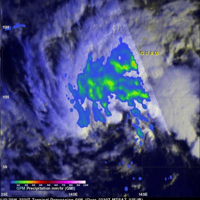
The first tropical depression of the 2015 western Pacific season formed southwest of Guam on January 13 and is predicted to intensify into a tropical storm while headed toward the Philippines. NASA's TRMM and GPM satellites provided a look at Tropical Depression Mekkhala's rainfall data that showed the area of moderate rainfall had expanded as the storm strengthened on January 13. Mekkhala was previously known as Tropical Depression 01W until January 14 when it was renamed. Both the Global Precipitation Measurement (GPM) core satellite and the Tropical Rainfall Measuring Mission (TRMM)

Tropical Storm Faxai

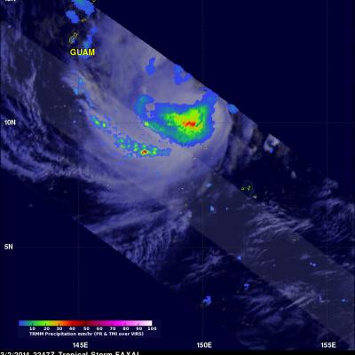
Tropical storm FAXAI meandered in a area southeast of Guam for the past few days and is now predicted to move toward the north passing well to the east of Guam. The TRMM satellite had a good daytime view of the tropical storm on March 2, 2247 UTC. TRMM's Microwave Imager (TMI) and Precipitation Radar (PR) data revealed that FAXAI had heavy rain falling at a rate of over 89 mm/hr (~3.5 inches). A few rainshowers from FAXAI are shown affecting GUAM.