
IMERG

IMERG Early/Late Run Precipitation Anomalies

Beginning on April 6, anomalies in the input SSMIS F17 precipitation estimates were detected in the IMERG Early and Late runs. These anomalies manifest as episodic “swath shaped” areas of high precipitation over land which appear to affect most orbits to some degree. The root cause is degradation in the 37 GHz V polarization channel. On April 13 the issue was somewhat mitigated but we continue to monitor the situation. Please let us know if you detect these (or other anomalies) in the IMERG Early and Late Runs after April 13.
Potential Upcoming Data Outages Due to Severe Winter Storm

The Washington, DC area is about to get hit with a record-level snow storm, with attendant disruptions to work schedules, travel, communications, and power. If you find that the TMPA-RT products drop out, it is safe to assume that some combination of these effects is preventing production, and we will work to restore service when that is possible.

Paraguay's Deadly Flooding Rainfall Measured By IMERG

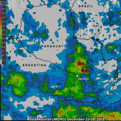
Widespread flooding has recently affected tens of thousands of people in South America. Paraguay has been especially hard hit with the worst flooding in decades occurring after heavy summer rainfall. An estimated 90,000 people have been evacuated from their homes. Storms and flooding caused the deaths of at least six people in Asuncion, Paraguay. The analysis above was generated using the Integrated Multi-satellitE Retrievals for GPM (IMERG) data product. IMERG rainfall estimates are computed in near-realtime. IMERG data indicates that over 350 mm (13.8 inches) of rain fell northeast of

Northwest's Extreme Rainfall Checked By IMERG

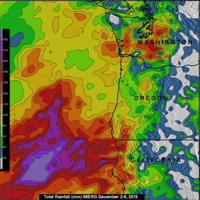
During the past week moisture from the tropics has been pumped into the Pacific Northwest by the "Pineapple Express". Resulting extreme rainfall has led to widespread flooding and landslides. The continued "training" of rainfall into the area has caused flooding in the Portland, Oregon area with at least one death reported. Western Washington is also on flood alert due to the deluge. Rainfall that occurred during the past week (December 2-9, 2015) was measured with data from NASA's Integrated Multi-satellitE Retrievals for GPM (IMERG). IMERG found that many areas from northern California

IMERG Measures Flooding Rainfall In Northwest England

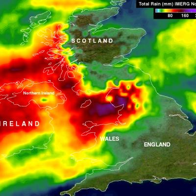
In addition to destructive winds measured at 81 mph (70 kts) a powerful winter storm called Desmond dropped record rainfall in northwest England over the past weekend. Desmond's unusually heavy rainfall resulted in wide spread damaging floods. Data from NASA's Integrated Multi-satellitE Retrievals for GPM (IMERG) were used to estimate rainfall for the period from November 30 to December 7, 2015. This analysis found that some rainfall near the Irish Sea measured over 392 mm (~15.4 inches) during this period. As much as 304 mm (~12 inches) of rain were reported to have fallen in only 24 hours

NASA's IMERG Adds Up More of Southern India's Extreme Rainfall

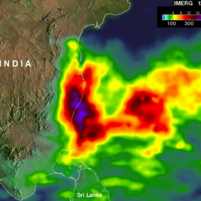
Data from the Global Precipitation Measurement or GPM mission core satellite were used to help estimate rainfall data. GPM is a satellite co-managed by both NASA and the Japan Aerospace Exploration Agency. The city of Chennai on India's southeastern coast was hit particularly hard. More than 260 deaths have been reported in the Indian state of Tamil Nadu. Data from NASA's Integrated Multi-satellitE Retrievals for GPM (IMERG) were used to estimate the flooding rainfall that fell from November 28 to Dec. 4, 2015. Over 400 mm (15.7 inches) of rainfall were estimated over areas south of Chennai
Hurricane Patricia Makes Landfall in Mexico
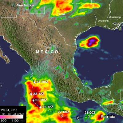
The eye of hurricane Patricia hit the Mexican coast on October 23, 2015 at approximately 6:15 PM CDT(2315 UTC)near Cuixmala, Mexico. The maximum winds at that time were estimated to be 143 kts (165 mph). Patricia is weakening rapidly but continued heavy rain is expected to cause flash floods and mudslides in the Mexican states of Nayarit, Jalisco, Colima, Michoacan and Guerrero through Saturday October 24, 2015. Over the weekend the remants of Patricia are also expected to add to the extreme rainfall in Texas. Rainfall from a stalled front that has been causing flooding in northern and central...
NASA Aids Response to Carolina Flooding
It was rain that wouldn't quit. A weather system fueled by warm moisture streaming in from the Atlantic Ocean on Oct. 3 and 4 relentlessly dumped between one and two feet of rain across most of South Carolina. The result was rivers topping their banks and dams bursting. Catastrophic flooding followed across most of the state, which has left residents in some areas without power or clean drinking water. Tracking and predicting the deluge, both as rain and then floodwater, are the first steps to help protect people in harm's way. State and federal emergency managers have been on the front lines...

IMERG Measures Historic Rainfall With A Nor'easter and Joaquin

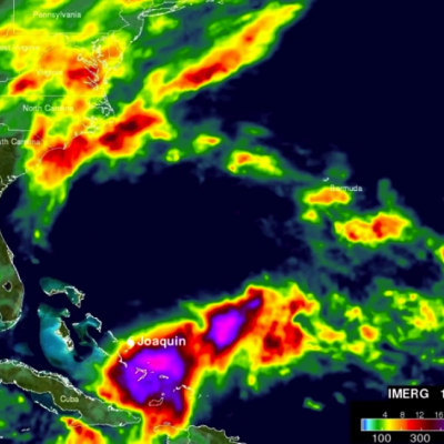
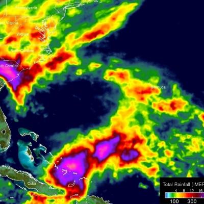
NASA's Integrated Multi-satellitE Retrievals for GPM (IMERG) data were used to estimate the historic amount of rain that fell during the past week in the Carolinas. A "fire hose" of moisture has been pumped into the Carolinas from hurricane Joaquin resulting in wide spread flooding. Over two feet of rain have been reported in South Carolina. This analysis indicated that major hurricane Joaquin also dropped over 700 mm (27.5 inches) in the Bahamas. Hurricane Joaquin has weakened from a category four hurricane in the Bahamas to a category one hurricane affecting Bermuda. Click here to see a

Typhoon Dujuan Batters and Drenches Taiwan

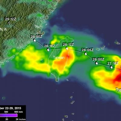
Typhoon Dujuan formed in the western Pacific Ocean northwest of Guam on September 21, 2015. Dujuan intensified to a super typhoon with winds of 125 kts (144 mph) on September 27, 2015 as it approached Taiwan. The island of Taiwan experienced extreme rainfall and damaging winds with the passage of typhoon Dujuan. The typhoon also caused hundreds of injuries and at least three deaths in Taiwan. After pounding Taiwan the typhoon started weakening before hitting China. Dujuan dropped light to moderate rainfall over a large area of coastal China while dissipating. A preliminary analysis of Rainfall