
IMERG

GPM Gets a Ton of Kilo

Submitted by JacobAdmin on
Video Embed

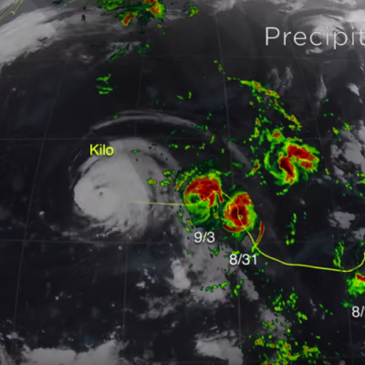
The Global Precipitation Measurement (GPM) mission core satellite provided many views of Tropical Cyclone Kilo over its very long life. GPM is a satellite co-managed by NASA and the Japan Aerospace Exploration Agency that has the ability to analyze rainfall and cloud heights. GPM was able to provide data on Kilo over its 21 day life-span. 
https://www.youtube.com/watch?v=8eIwMXnU8IA&feature=youtu.be
A narrated visualization of Typhoon Kilo. Click here for a full transcript. Click here to download this video in high resolution from the NASA Goddard Scientific Visualization Studio. The Global Precipitation Measurement (GPM) mission core satellite provided many views of Tropical Cyclone Kilo over its very long life. GPM is a satellite co-managed by NASA and the Japan Aerospace Exploration Agency that has the ability to analyze rainfall and cloud heights. GPM was able to provide data on Kilo over its 21 day life-span. The GPM core observatory satellite flew over Kilo on August 25, 2015 at...
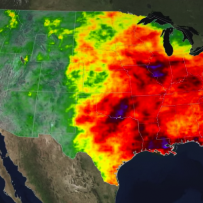
A Tale of Two Extremes: Rainfall Across the US
The United States has seen a tale of two extremes this year, with drenching rains in the eastern half of the country and persistent drought in the west. A new visualization of rainfall data collected from space shows the stark contrast between east and west for the first half of 2015. The accumulated precipitation product visualized here begins on Jan. 1, 2015, and runs through July 16, 2015. This visualization shows the heavy rainfall throughout Northern Texas and across Oklahoma as well as the drought in Southern California. Credits: NASA Goddard's Scientific Visualization Studio Download...

IMERG Sees Heavy Rain Over United States

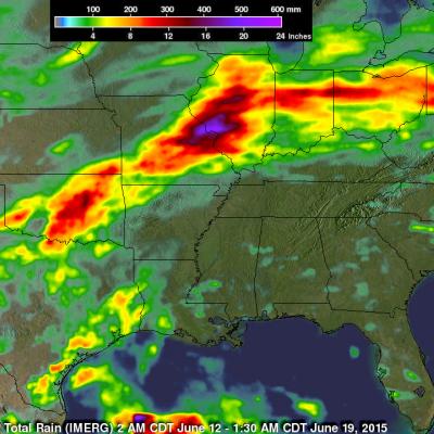
During the past week the combination of tropical storm Bill's landfall and a slowly moving frontal system extending from the Midwest to the Northeastern states dropped extreme rainfall from Texas' Gulf coast to the northeastern states. Data from NASA's Integrated Multi-satellitE Retrievals for GPM (IMERG) were used in this analysis to estimate the extreme amount of rain that fell during the past seven days. Tropical Storm Bill and it's remnants caused very heavy rainfall while moving through Texas and Oklahoma. Over a foot of rain was reported in Oklahoma resulting in at least two deaths. The

IMERG Sees Gulf Rainfall With Tropical Storm Bill

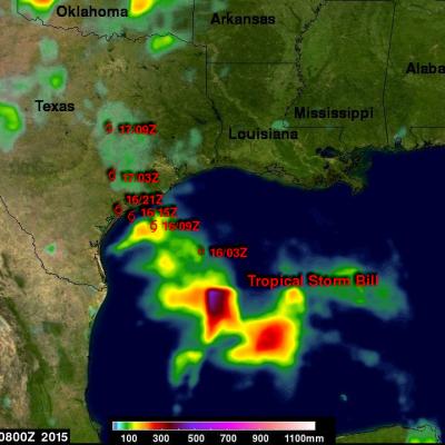
Tropical storm Bill became the second named tropical cyclone in the Atlantic Ocean Basin when it formed in the western Gulf Of Mexico on June 16, 2015. Data from the NASA's Integrated Multi-satellitE Retrievals for GPM (IMERG) was used in this analysis to estimate rainfall from Tropical Storm Bill. Precipitation was analyzed from the time when tropical storm Bill was forming in the Gulf Of Mexico on Monday June 15, 2015 until early this morning at 0800 UTC (4 AM CDT). The storm was dropping heavy rainfall over Texas this morning but this analysis indicates that the heaviest rainfall totals, up

Large Gap in Near-Realtime Data

Starting at 08:38 UTC PPS stopped getting data from the GPM Mission Operations Center. Data was resumed at 17:21 UTC. However, new GPS data was sent before older GPS data. The science data was sent out of order with the GPS data. This meant that about 125 mins of 1B and 1C GMI data had no geolocation and perhaps more after this had questionable geolocation. The same issues obviously also affected the radar and combined NRT which are just missing for the period between 8:30 UTC and 17:30 UTC. All of these issues impacted the early version of the IMERG data. The late product will also be

IMERG Dataset Back Online

The issues with NOAA's 4-km Merged IR data are closed and the IMERG Early and Late Runs have been restarted from the point at which they stopped. This will provide a continuous record for each, but it also means that it will take a while to process the backlog of data and catch up to the nominal latency.

IMERG Data Temporarily Suspended

Due to an outage of the input 4-km IR data, the IMERG early and late runs began failing to execute on the April 14. Because of the loss of NOAA hourly IR data, PPS has had to shut off the production of NRT early and late IMERG production. We have received no valid IR data since April 14 17:00 UTC and no IR data at all since April 15 09:00 UTC. The software is able to deal with bad data by skipping it but it is currently not configured to handle the situation of not receiving any data at all. We have received information that there are product problems at NOAA but have not received any
GPM's Worldwide Tour of Global Precipitation
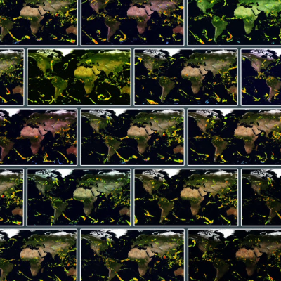
Rain, snow, hail, ice, and every mix in between make up the precipitation that touches everyone on our planet. But precipitation doesn't fall equally in all places around the world, as seen in NASA's new animation that captures every shower, snowstorm and tropical cyclone over a six-day period in August 2014. The time lapse was created from data captured by the Global Precipitation Measurement (GPM) satellite mission, now just over a year old, which scientists are using to better understand freshwater resources, natural disasters, crop health and more. Image Credit: NASA's Goddard Space Flight...

IMERG Data Now in Giovanni-4

The NASA Goddard Earth Sciences Data and Information Services Center (GES DISC) has recently added all of the half-hourly and monthly *Final* IMERG data variables to the next generation of Giovanni, Giovanni-4 (G4). Giovanni is a Web-based application developed by the GES DISC that provides a simple and intuitive way for users to visualize, analyze, and access vast amounts of Earth science remote sensing data, without having to download the data. Learn more: http://disc.sci.gsfc.nasa.gov/gesNews/imerg_in_G4