Lehar

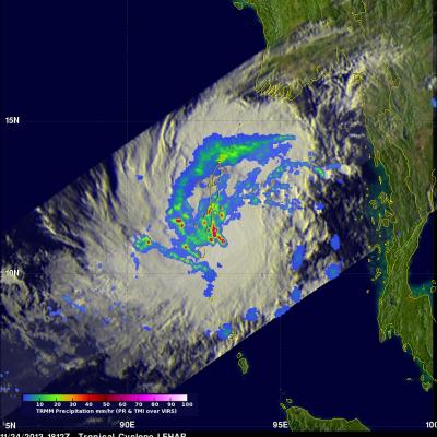
Tropical Cyclone Lehar Moving Toward India

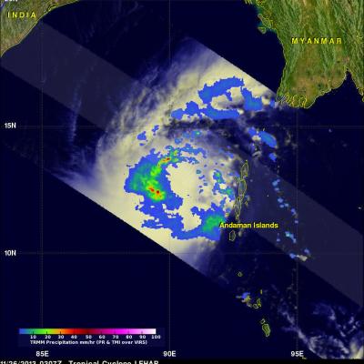
Tropical cyclone LEHAR, located in the Bay Of Bengal, continues to gain intensity while heading toward the same area of India where a much weaker tropical cyclone HELEN recently came ashore. The Joint Typhoon Warning Center (JTWC) predicts that LEHAR's sustained wind speeds will reach 95 kts (~109 mph) on November 27, 2013 and then decrease to about 85 kts (~98 mph) before hitting India's east-central coast. The TRMM satellite flew above tropical cyclone LEHAR on November 26, 2013 at 0307 UTC and captured data used in the image above. Rainfall derived from TRMM's Microwave Imager (TMI) and

Tropical Cyclone Lehar In The Bay Of Bengal

Today tropical cyclone LEHAR's estimated sustained wind speeds reached 65kts (~75 mph). The most powerful tropical cyclone in the Bay Of Bengal this year was deadly tropical cyclone PHAILIN that moved through the area in October with wind speeds of 140kts (~161 mph). This means that LEHAR is the second most powerful tropical cyclone to form in the Bay Of Bengal this year. The TRMM satellite collected data used in the image on the left when the TRMM satellite passed above LEHAR on November 24, 2013 at 1812 UTC. At that time LEHAR was intensifying with tropical storm force winds estimated to be