Mississippi

GPM Sees Powerful Thunderstorms In Landfalling Hurricane Nate

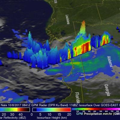
The GPM core observatory satellite passed above powerful thunderstorms within land falling hurricane Nate on October 8, 2017 at 4:41 AM EDT (0841 UTC). GPM's Dual-Frequency Precipitation Radar (DPR) found that a few storms over southwestern Alabama were dropping rain at the extreme rate of greater than 4 inches (102 mm) per hour. This 3-D slice by GPM's radar (DPR Ku Band) shows the structure of precipitation within the powerful thunderstorms near the center of hurricane Nate. A few thunderstorms over Alabama were found by GPM's radar to have tops reaching heights above 10.5 miles (17 km).
Rainfall Floods the Mississippi River
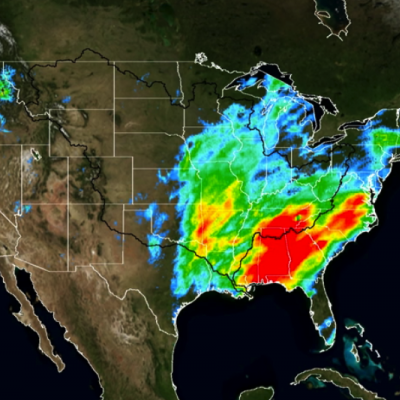
A series of winter storms brought more than 20 inches of rainfall to the Midwest and southeastern United States in December 2015. Massive flooding followed throughout both the regions. An animation of rainfall data from those storms was created at NASA's Goddard Space Flight Center in Greenbelt, Maryland. This animation shows the accumulation of rainfall over the United Stated during December 2015, from the IMERG precipitation dataset. The black outline indicates the Mississippi-Missouri River basin. This version has been edited to only show the periods of significant rainfall during the month...

TRMM Sees Tornado Spawning Thunderstorms

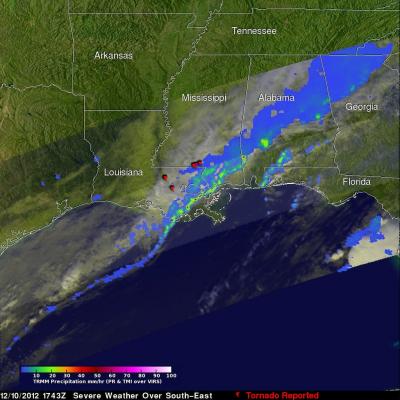
In the United States tornadoes develop most often in the spring when warm moist unstable air accompanies strong fronts and fluctuating upper-air systems. There is a also a slight increase in tornado activity in late October and November. Tornadoes form least often in December and January so the tornadoes that occurred yesterday over the south-eastern United States were unusual. The TRMM satellite was flying over on December 10, 2012 at 1743 UTC (12:43 PM EST) and captured data showing tornado spawning thunderstorms within a frontal system moving through Louisiana, Mississippi, Alabama, Georgia