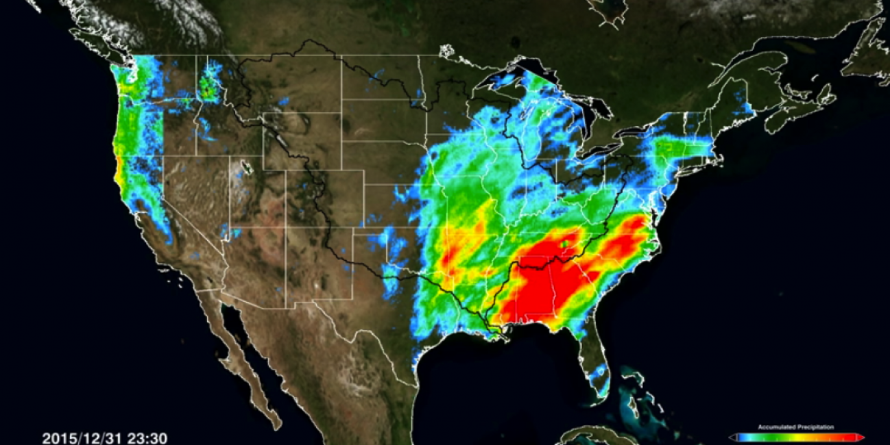
Rainfall Floods the Mississippi River
A series of winter storms brought more than 20 inches of rainfall to the Midwest and southeastern United States in December 2015. Massive flooding followed throughout both the regions. An animation of rainfall data from those storms was created at NASA's Goddard Space Flight Center in Greenbelt, Maryland.
Credits: NASA/Goddard Space Flight Center
This video is public domain and can be downloaded at: http://svs.gsfc.nasa.gov/cgi-bin/details.cgi?aid=4418
The animation shows the accumulation of rainfall from December's three major storm systems that took place on Dec. 1 through 3, Dec. 13 through 16, and Dec. 21 through 31. The observations are from NASA's Global Precipitation Measurement (GPM) mission. Red colors indicate accumulate rainfall of 20 inches, yellow show 10-12 inches, green 6-10 inches, and shades of blue 2-6 inches. The extent of the area that drains into the Mississippi River is outlined in black.
In the Midwest rainwater swelled the banks of rivers and tributaries that then feed the Mississippi River, leading to flooding in Missouri, Illinois, Oklahoma, Arkansas and Mississippi. The crest of the Mississippi River travelled downstream through Louisiana toward the Gulf of Mexico the first week of January 2016, passing through New Orleans, which opened the Bonnet Carre Spillway north of the city to prevent flooding.
Alabama and Georgia and other areas in the southeast were hardest hit by rainstorms that arrived Christmas week, which led to massive flooding and declarations of a state of emergency in Alabama and northern Georgia.
For information about GPM, visit: http://pmm.nasa.gov/gpm

