Rina

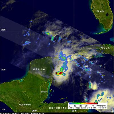
Storminess Increases North Of Dissipating Rina

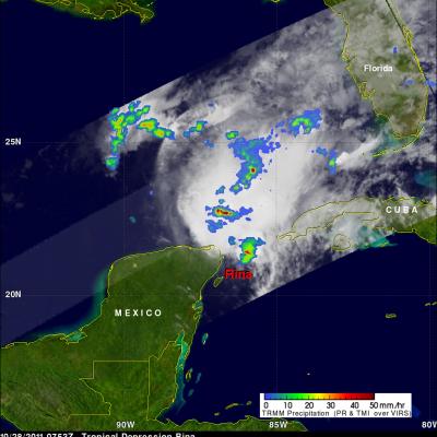
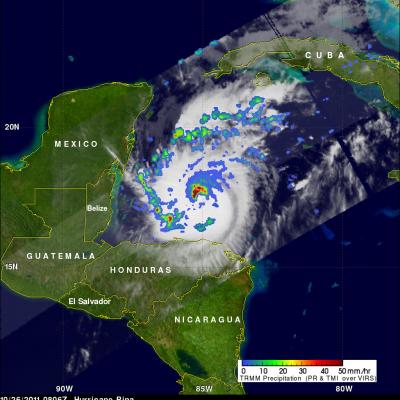
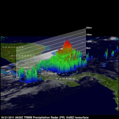
The TRMM satellite passed over rapidly dissipating tropical storm Rina twice on 28 October 2011. The images shown above were made using TRMM's Microwave Imager (TMI) and Precipitation Radar (PR) data collected by the first orbit before daylight at 0753 UTC (3:53 AM EDT). Tropical storm Rita was still dropping heavy rainfall in a small area off the northeastern tip of the Yucatan Peninsula but an even larger area of convective rainfall had formed to the north-northwest of Rina. The image on the upper right , looking toward the east, was made from TRMM's Precipitation Radar (PR) data. It reveals

TRMM Sees A Weakened Rina

The TRMM satellite had a good daytime view of a much smaller tropical storm Rina on 27 October 2011 at 1522 UTC (10:22 AM CTD). Rina had decreased in size and strength due to vertical wind shear and dry air entrainment. Rainfall from TRMM's Microwave Imager (TMI) shows that heavy rainfall with the much diminished tropical cyclone was then only located off the coast of the Yucatan Peninsula. Click here to see a movie that fades from the visible image to the rainfall image.

Hurricane Rina Threatens the Yucatan

After a two-week period without any storms, the 2011 Atlantic hurricane season has picked up with the arrival of Hurricane Rina. Rina began as a tropical depression on October 23rd in the western Caribbean. Like many storms that form later in the season, Rina's formation was influenced by a midlatitude front that had penetrated deeper into the Tropics over warm water. These fronts can provide a focus for showers and thunderstorms that can eventually evolve into a tropical cyclone. During the peak of hurricane season in late August and September, a lot of storms form out over the central

TRMM Sees Tropical Storm Rina Forming

The National Hurricane Center (NHC) upgraded an area of disturbed weather in the Caribbean to tropical depression eighteen and then to tropical storm Rina on 23 October 2011. The TRMM satellite flew over the forming tropical cyclone on 23 October 2011 at 1728 UTC (1:28 PM EDT). Data from TRMM's Microwave Imager (TMI) and Precipitation Radar (PR) showed that the future storm already was well organized and had a large area of heavy rainfall extending toward the northeast from eastern Honduras.