snowfall

GPM Gets Flake-y
In this video GPM Project Scientist Dr. Gail Skofronick-Jackson explains how scientists can measure the size, shape and distribution of snow particles, layer by layer, in a storm using GPM. The Global Precipitation Measurement mission is an international satellite project that provides next-generation observations of rain and snow worldwide every three hours.
GPM Catches Nor'easter over New England
Video Embed
JacobAdmin Tue, 04/11/2017

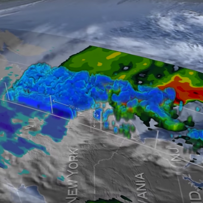
At the time of the Global Precipitation Measurement (GPM) Core Observatory overpass (April 1, 2017, 0550 UTC), the storm's center of low pressure was south of Long Island. At the mid-levels of the atmosphere, the circulation was centered over northeast Pennsylvania. This led to a classic overrunning, warm conveyor setup, which happened when the counterclockwise low level flow drew in cold air out of the north/northeast (hence "Nor'easter") from Canada.

GPM Catches Nor'easter over New England
At the time of the Global Precipitation Measurement (GPM) Core Observatory overpass (April 1, 2017, 0550 UTC), the storm's center of low pressure was south of Long Island. At the mid-levels of the atmosphere, the circulation was centered over northeast Pennsylvania. This led to a classic overrunning, warm conveyor setup, which happened when the counterclockwise low level flow drew in cold air out of the north/northeast (hence "Nor'easter") from Canada. Higher up, warm and moist air from further south was lifted over this cold air and resulted in precipitation in the form of snow at the surface...
GPM Measures The Altitudes of Hawaii's Rain And Snow JacobAdmin Wed, 12/07/2016
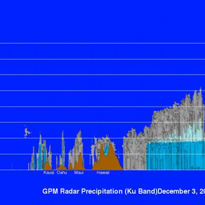
The mountains of Mauna Kea and Mauna Loa in the Hawaiian Islands have recently received heavy snowfall. Hawaii's balmy temperatures normally reach above 80 degrees Fahrenheit (27 C) at sea level on beaches such as Oahu's Waikiki but temperatures fall below freezing at the altitudes of tall mountain peaks on the Big Island. At 13,802 feet (4.2 km) Mauna Kea is Hawaii's tallest mountain. Snowfall is frequently seen on Mauna Kea's peak. The nature of precipitation in the Hawaiian Islands was recently examined using data collected by the GPM core observatory satellite. GPM flew over the Hawaiian
GPM's First Global Rainfall and Snowfall Map
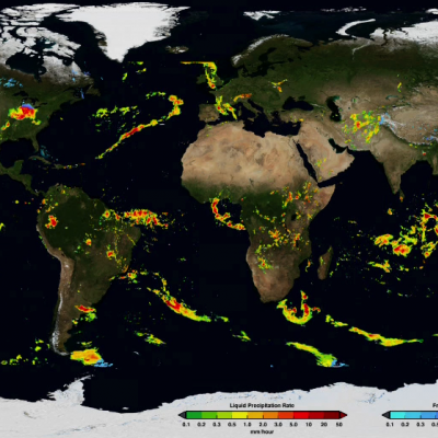
The Global Precipitation Measurement mission has produced its first global map of rainfall and snowfall. Like a lead violin tuning an orchestra, the GPM Core Observatory – launched one year ago on Feb. 27, 2014, as a collaboration between NASA and the Japan Aerospace Exploration Agency – acts as the standard to unify precipitation measurements from a network of 12 satellites. The result is NASA's Integrated Multi-satellite Retrievals for GPM data product, called IMERG, which combines all of these data from 12 satellites into a single, seamless map. The map covers more of the globe than any...
Goddard Intern Analyzing Snowfall Data for GPM
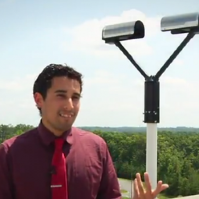
Summer intern Jorel Torres, a graduate student from the South Dakota School of Mines and Technology, talks about snow research and the value of hard work, persistence, and passion. Snow awes and annoys, brings nostalgia or abhorrence. For Jorel Torres, snow makes him curious—so much that he studies it. For the past ten weeks, Torres compared various ground measurements of snow to data from NASA’s Global Precipitation Measurement mission as an intern at NASA’s Goddard Space Flight Center. The snow, Torres said, is important to the Earth’s hydrological cycle as it is more unpredictable, thus...

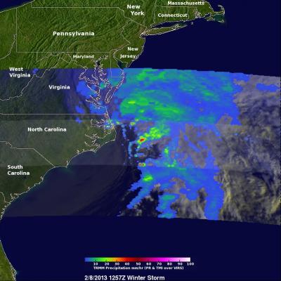
TRMM Sees Intensifying Winter Storm

At 1257 UTC (7:57 AM EST) this morning the TRMM satellite passed above a rapidly deepening low pressure center over coastal North Carolina. TRMM already saw stormy weather with this low when it was forming yesterday along the Gulf coast. Another area of low pressure moving from the Mid-West is predicted to merge with this storm and result in extreme blizzard conditions over the North-East. Near hurricane force winds and snowfall depths of over 610mm (~24 inches) are predicted in some areas from New York to Boston. An analysis of rainfall from TRMM's Microwave Imager (TMI) and Precipitation

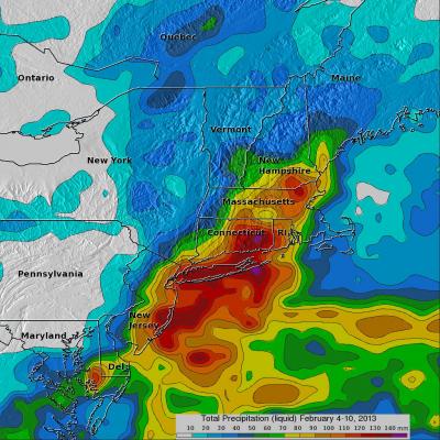
2013 New England Blizzard

As accurately predicted by the National Weather Service, a blizzard dropped extreme amounts of snow over the North-East beginning on February 8, 2013. An amazing snow depth of 38 inches (~965 mm) was reported in Milford, Connecticut. The blizzard was reportedly the cause of at least 14 deaths in the United States and Canada. The TRMM-based, near-real time Multi-satellite Precipitation Analysis (TMPA) at the NASA Goddard Space Flight Center is used to estimate precipitation for much of the globe. TMPA (liquid) precipitation totals (mm) are shown for the week from February 4-10 when the blizzard
GPM Let it Snow Photo Contest banner
This page redirects to the GPM Let it Snow Photo Contest. Click here if you are not automatically redirected.

GCPEx Wraps Up Cold Season Field Campaign

Submitted by JacobAdmin on Wed, 03/21/2012
Video Embed

For six weeks in Ontario, Canada, scientists and engineers lead a field campaign to study the science and mechanics of falling snow. The datasets retrieved will be used to generate algorithms which translate what the GPM Core satellite "sees" into precipitation rates, including that of falling snow. Ground validation science manager Walt Petersen gives a summary of the GCPEx field campaign. Field campaigns are critical in improving satellite observations and precipitation measurements. 

Video Text: