Soulik

GPM Views "Truck-Tire" Eyewall of Typhoon Soulik

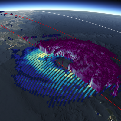
View Fullscreen in STORM Event Viewer Avoiding Kyushu, Typhoon Soulik instead barrelled toward the Northern Ryukyu islands, with the 'truck-tire' eyewall impacting Amami (in the south) and Yakushima (in the north) Islands in this overflight. It featured winds approaching 100 knots as it moved northwestward. Soulik is expected to recurve toward the western coast of Korea, where it is likely to have devastating impacts to the majority of the peninsula depending on its ability to maintain intensity.

Weaker Typhoon Soulik Heads Towards Taiwan

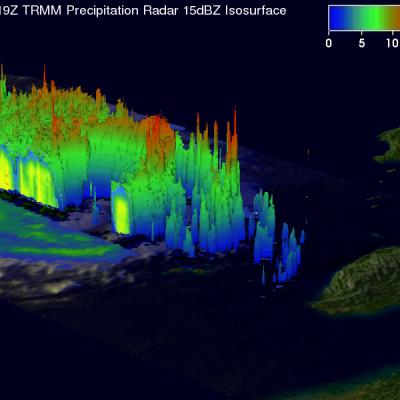
TRMM satellite again flew above weakening typhoon Soulik on July 11, 2013 at 2119 UTC. Data from TRMM's Microwave Imager (TMI) and Precipitation Radar (PR) instruments show that Soulik had weakened considerably. The eye diameter was shown to be much greater than when TRMM passed over super typhoon Soulik about 7 hours earlier. This TRMM Precipitation Radar 3-D view (from the northwest) shows typhoon Soulik east of Taiwan. The structure of Soulik's large eye is clearly shown by this TRMM PR slice through the weakening typhoon. Soulik is predicted by the Joint Typhoon Warning Center (JTWC) to be

Super Typhoon Soulik Forms in the Pacific

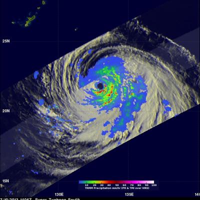
Typhoon Soulik became the first super typhoon of the year when the Joint Typhoon Warning Center estimated that it's sustained winds had increased to 125 knots (~144 mph), which is equivalent to a Category 4 hurricane on the US Saffir-Simpson scale, at 00 UTC on the 10th of July. Soulik began as a tropical depression on the 8th (local time) about 120 miles (~195 km) east of the Northern Mariana Islands and quickly became a typhoon 24 hours later after moving westward into the Philippine Sea where it continued to intensify. TRMM captured this latest image of Soulik in the central Philippine Sea