tropical disturbance

Tropical Disturbance Threatens India and Bangladesh

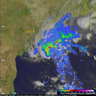
A tropical disturbance that recently formed in the Bay Of Bengal may cause heavy rainfall in the next few days along coastal India's eastern state of Odisha and southern Bangladesh. The low is predicted to move northeastward over the warm waters of the Bay Of Bengal but according to the Joint Typhoon Warning Center (JTWC) has only a medium chance of developing into a tropical cyclone. High vertical wind shear is forecast to keep the tropical disturbance from intensifying. The GPM core observatory flew above the low on November 4, 2016 at 0026 UTC. GPM saw that the low contained some strong

GPM Examines Threatening Tropical Disturbance

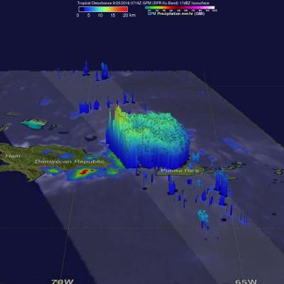
On August 25, 2016 at 0716 UTC (3:16 AM EDT) the GPM core observatory satellite had an excellent look at an area of low pressure associated with a tropical wave moving past the northern Dominican Republic. The National Hurricane Center (NHC) has been monitoring this area of disturbed weather for potential development into a tropical cyclone. This low is predicted by the NHC to produce heavy rainfall as it continues moving toward the northeast. The development of a tropical storm or hurricane moving in this direction could pose future danger to the Bahamas and the southeastern United States

TRMM Again Examines Energetic 92B

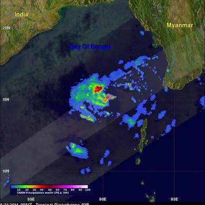
The tropical disturbance (92B) in the Bay Of Bengal was raining heavily when the TRMM satellite flew almost directly above on May 21, 2014 at 0051 UTC. TRMM's Precipitation Radar (PR) revealed that rain was falling at the extreme rate of over 191 mm/hr (about 7.5 inches) in powerful convective storms in the center of the Bay Of Bengal well to the east of India. TRMM's Precipitation Radar data were also used to construct this simulated 3-D view, looking toward the east from India, of 92B's rainfall structure. TRMM PR pulled away a veil of clouds and revealed that some powerful convective storm

Tropical Disturbance 91B

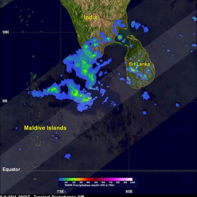
A tropical low was affecting southern India and Sri Lanka on May 6, 2014 at 0809 UTC when the TRMM satellite flew above. The TRMM satellite was launched by NASA and JAXA in 1997 with the first earth orbiting active/passive instrument package to study the intensity and structure of tropical rainfall. The GPM satellite that was launched on February 27, 2014 will continue TRMM's highly successful mission of monitoring precipitation from space. TRMM' Precipitation Radar (PR) data were used in this 3-D view (from the west) of rainfall structure within this area of disturbed tropical weather. TRMM