Data Access

Data Access content

Date Last Updated
January 3rd, 2020
Document Description

This document describes the algorithm and processing sequence for the Integrated Multi-satellitE Retrievals for GPM (IMERG).  This algorithm is intended to intercalibrate, merge, and interpolate “all” satellite microwave precipitation estimates, together with microwave-calibrated infrared (IR) satellite estimates, precipitation gauge analyses, and potentially other precipitation estimators at fine time and space scales for the TRMM and GPM eras over the entire globe.

File Downloads
Date Last Updated
October 6th, 2020
Document Description

In IMERG up through V05, the cloud motion vector computation approach used is that pioneered in CMORPH (Joyce et al. 2011), in which motion vectors are computed from 4-km geosynchronous infrared (GEO-IR) brightness temperatures. Hence, the motion vectors reflect cloud top motions. However, there are two main limitations in using GEO-IR. The first limitation is that cloud top motions may not match precipitation motions due to both wind shear and the growth and decay of precipitation systems.

Anomalies in TMPA-RT Dec. 18 - 19, 2016

Anomalies in the DMSP F-16 input data for the TMPA-RT created streaks of precipitation over open-ocean regions. We have now deleted faulty data and rerun the TMPA-RT for the period: 18 December 2016 at 09 UTC to 19 December 2016 at 18 UTC. Please re-pull the affected data files. There appears to be no corresponding issue with the IMERG data files due to different quality control routines.
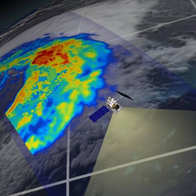
GPM flying over Earth with a data swath visualized.
Overview The PMM Publisher API can be used to automatically retrieve precipitation and related applications datasets and associated metadata for further processing by your tool of choice. Here we will outline the basic structure of requesting data from the API and interpretting the API response. Initial Request The initial request will return a collection of datasets (in the form of a structured JSON object) that match to the parameters you specify, including associated metadata about each dataset. You can then use the actions specified within the object returned to download the actual data...

Gauge Combination Error in 2016, Affects 3B42/43 and IMERG Final Run

We have discovered that the gauge analysis was erroneously omitted from the "production" 3B42/43 products starting with January 2016 due to issues with handling a change of data format. Thus, the production 3B42/43 are being re-computed. This does not affect the TMPA-RT suite of products, since no month-to-month gauge data are used. Note this issue also affects the current Version 3 IMERG Final Run products for January 2016. They are being recomputed as well. The current Version 3 IMERG Early and Late Runs are not affected. An update will be provided here when the corrected products are ready.

Jan. 2016 GPM IMERG and Jan.-Jun. 2016 TMPA 3B42/3B43 Data Products are Being Recalled and Replaced

UPDATE 9/27/16: January 2016 IMERG has been regenerated and posted. This was necessary due to an error that omitted the gauge analysis in the Final products. Also, 3B42/3B43 have been recomputed and posted. Let me know if you have any further questions. --- PPS has removed the January 2016 GPM IMERG and January through June 2016 3B42/3B43 TMPA products from our ftp archive: ftp://arthurhou.pps.eosdis.nasa.gov/ and STORM: https://storm.pps.eosdis.nasa.gov/storm/ The GPM science team discovered that the IMERG final products for Jan 2016 and the Jan-Jun 2016 TMPA 3B42/3B43 products for which we

PPS Down for Temporary Maintenance 6/7/16

The PPS (Precipitation Processing System) will be down today, June 07, 2016 from 8:00am -14:00pm EDT (12:00 - 18:00 UTC). for scheduled maintenance. During this time all data transfers between PPS source and its consumer systems (GDAAC/DISC) as well as Science User services (FTP and STORM access) will be unavailable. You will be informed when PPS systems become available. We apologize for any inconvenience this may cause.
Document Description

This document describes the file naming conventions that will be used to name data products produced by the Precipitation Processing System (PPS) for the Global Precipitation Measurement (GPM) Mission. 

GPM flying over Earth with a data swath visualized.
LOADING Daily Precipitation 2mm 3mm 5mm 8mm 13mm 21mm 34mm 55mm 89mm 144mm 233mm 377mm Source: GPM Select Date: Select Dataset: GPM 30 Minute GPM 3 Hour GPM 1-Day GPM 3-Day GPM 7-Day Floods Nowcast Load Data Advanced Options Secondary Dataset: Floods Nowcast Subset Data to Viewport? (saves bandwidth) Dataset Info: Preview Image: - Downloads: - - - - - Search Locations Go Find Me Jump to Region North America South America Europe Africa Northern Asia Southern Asia

Large Gap in Near-Realtime Data

Starting at 08:38 UTC PPS stopped getting data from the GPM Mission Operations Center. Data was resumed at 17:21 UTC. However, new GPS data was sent before older GPS data. The science data was sent out of order with the GPS data. This meant that about 125 mins of 1B and 1C GMI data had no geolocation and perhaps more after this had questionable geolocation. The same issues obviously also affected the radar and combined NRT which are just missing for the period between 8:30 UTC and 17:30 UTC. All of these issues impacted the early version of the IMERG data. The late product will also be