Tropical Depression Two-E Forms
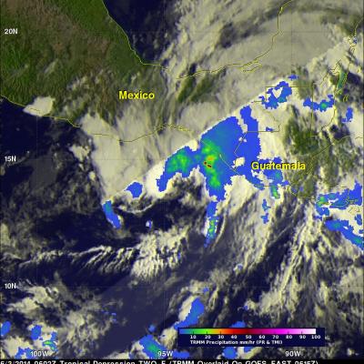
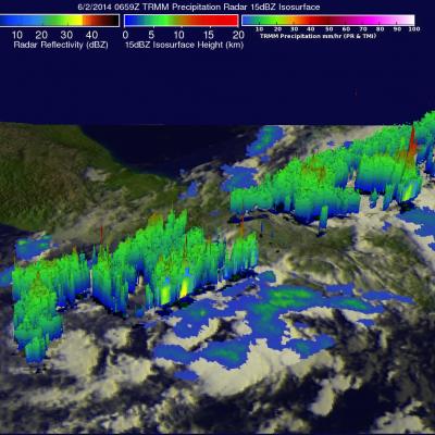
As predicted, yesterday afternoon a low pressure center south of the Gulf of Tehuantepec was classified as tropical depression TWO-E by the National Hurricane Center (NHC). The TRMM satellite passed over the area on June 3, 2014 at 0602 UTC (11PM PDT June 2, 2014) providing data for the TRMM rainfall analysis shown in brighter shades overlaid on an enhanced GOES-EAST 0615 UTC image. TRMM's Microwave Imager (TMI) instrument had a good view of TWO-E's center and indicated that rain northeast of there was falling at a rate of over 61 mm/hr ( about 2.4 inches). An NHC discussion said of tropical