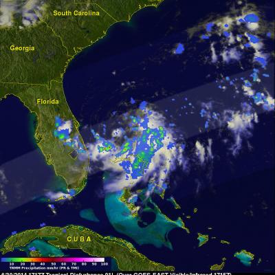
TRMM Sees New Tropical Storm Arthur
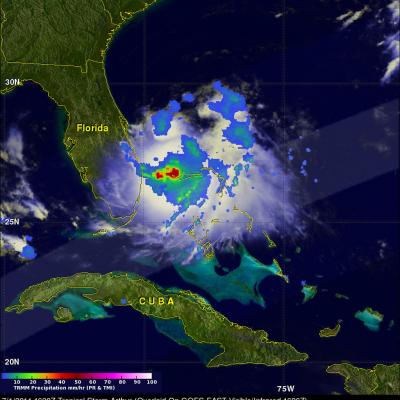
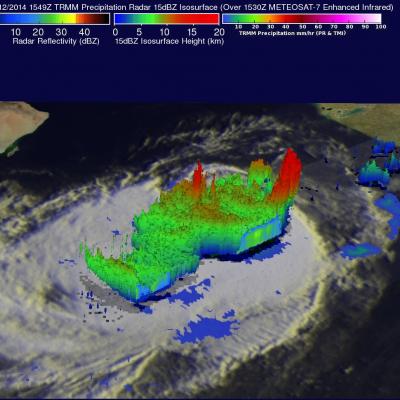
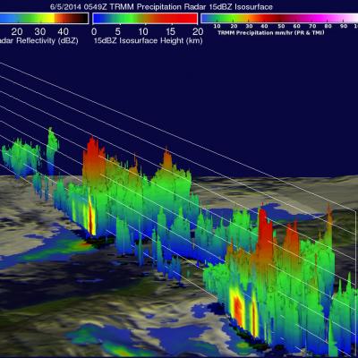
The TRMM satellite had a good daylight look at tropical storm Arthur on July 1, 2014 at 1620 UTC (12:20 PM EDT) less than two hours after it was upgraded from a tropical depression. Rainfall from TRMM's Microwave Imager (TMI) and Precipitation Radar (PR) data are shown overlaid on a GOES-EAST infrared/visible image collected at 1626 UTC (12:26 PM EDT). The location of very heavy rainfall around Arthur's center was shown using TMI data. TRMM PR data sliced through the southern half of the tropical storm. A 3-D view (from the west) using those data is shown above. Radar reflectivity values