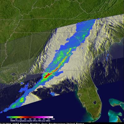
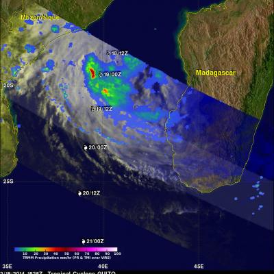
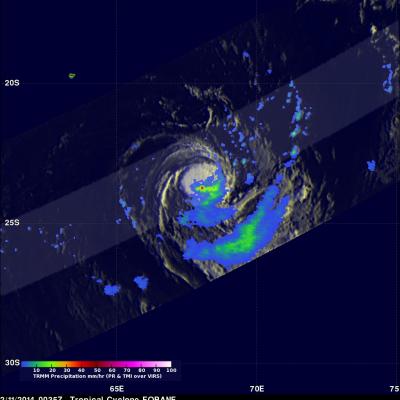
Tropical Storm Faxai Forms Southeast Of Guam
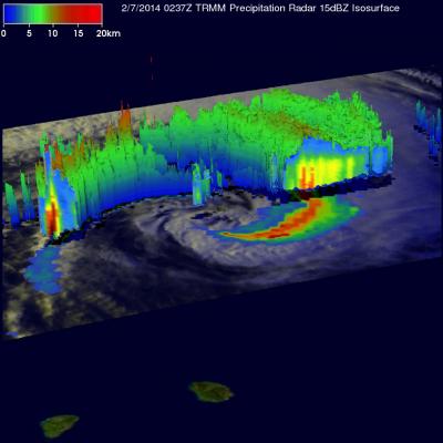
A tropical depression that developed southeast of Guam was upgraded to a tropical storm called FAXAI early Saturday morning (local time). The TRMM satellite has had several good looks of the tropical storm during it's formation. As it passed over head on February 27, 2014 at 2357 UTC the satellite had an outstanding daytime view of the developing tropical cyclone . Rainfall data collected by TRMM's Microwave Imager (TMI) and Precipitation Radar (PR) instruments are shown overlaid on enhanced visible and infrared images from TRMM's Visible and InfraRed Scanner (VIRS). TRMM PR data indicated