Heavy Rain Brings Flooding to Central and Northern Italy
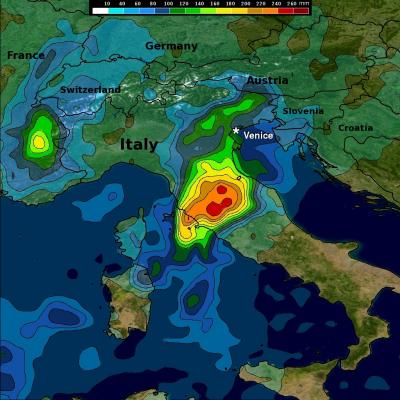
Beginning this past weekend, parts of central and northern Italy received several days of heavy rain as an upper-level trough situated over western Europe down through the Iberian Peninsula in conjunction with a persistent area of low pressure at the surface over the northern coast of Africa brought a steady flow of warm, moist, unstable air northeastward across the country from the western Mediterranean. A stationary frontal boundary draped across the northern third of the Italian Peninsula provided the focus for showers and storms in that part of the country. The rains caused flooding in