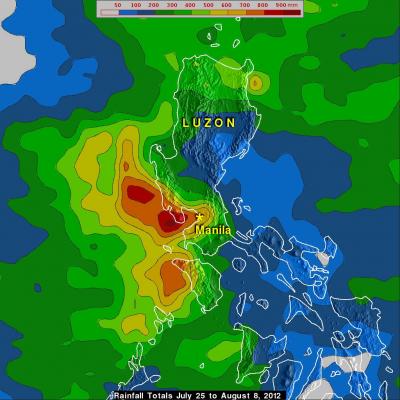
Deadly Super Storm Sandy's Rainfall
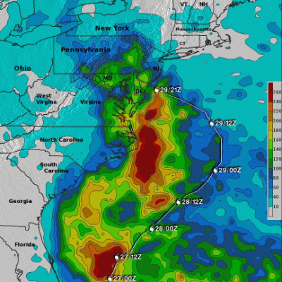
The reported death toll from hurricane Sandy's flooding and high winds has now reached above 120. Over 70 deaths were caused by Sandy in the Caribbean and recent reports bring the total to greater than 50 in the United States. Much of the recent deadly flooding along the northeastern United States coastlines was caused by super storm Sandy's storm surge. Strong winds from Sandy persistently pushed Atlantic ocean waters toward the coast. High tides that occurred at the same time also magnified the effects of the storm surge. Some flooding was also caused by long periods of heavy rainfall that