Ana Becomes First 2015 Atlantic Tropical Storm & Weakens Ashore
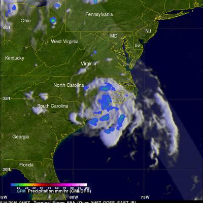
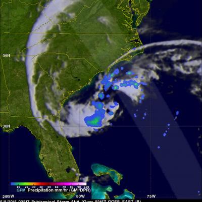
On May 9, 2015 at 1626 UTC ( 12:26 PM EDT) the GPM satellite flew over when Ana was making the change from subtropical storm to tropical storm. Convective storms near the inner-core region were warming the center of the storm with heat generated by condensation. GPM's Microwave Imager (GMI) measured rain falling at at rate of over 58.7 (2.31 inches) per hour in these convective storms near ANA's center. The lighter swath to the west of Ana's center shows the area viewed by GPM's Ku/Ka-band Dual-frequency Precipitation Radar (DPR). On Sunday morning (May 10, 2015) Tropical storm ANA dropped