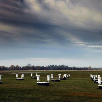
Ground Validation

Content related to ground validation activities and field campaigns.

PMM Article Image
On a Wednesday afternoon in June, a severe storm outbreak spawned huge thunderstorms across Iowa and western Illinois. NASA's Polarimetric precipitation radar was in place to scan the storms as they swept through the region. "It's unbelievable out here," Walt Petersen of NASA's Wallops Flight Facility in Virginia wrote in an email dispatch from Traer, Iowa. There, two NASA radars were stationed as part of the Iowa Flood Studies field campaign, which Petersen led, for the Global Precipitation Measurement, or GPM, mission. Caption: A cluster of rain gauges and soil moisture sensors deployed in...
GPM flying over Earth with a data swath visualized.
In total, 25 events were identified with two events classified as “clear air” flights conducted by the DC-8 to sample land surface emission characteristics. Table 4 summarizes case date and time, event type, and airborne data collection during the field project. Event total SWE amounts represent manual measurements taken by a Tretyakov gauge located inside a DFIR wind shield at CARE. Precipitation types are characterized as rain (R), snow (S), or mixed precipitation that could include ice pellets (R/S). Synoptic context/regime(s) were determined from the daily synopsis produced by the project...

GCPEx Wraps Up Cold Season Field Campaign

Submitted by JacobAdmin on Wed, 03/21/2012
Video Embed

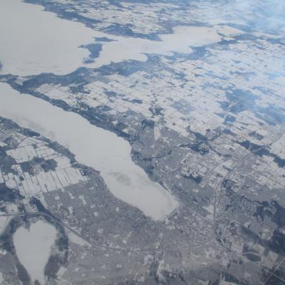
For six weeks in Ontario, Canada, scientists and engineers lead a field campaign to study the science and mechanics of falling snow. The datasets retrieved will be used to generate algorithms which translate what the GPM Core satellite "sees" into precipitation rates, including that of falling snow. Ground validation science manager Walt Petersen gives a summary of the GCPEx field campaign. Field campaigns are critical in improving satellite observations and precipitation measurements. 

Video Text:

Saving the Best for Last - Prelude to a Storm

Joe Munchak is a scientist at Goddard Space Flight Center who specializes in remote sensing of snow. This week he writes from the air in the DC-8 out of Bangor, Maine. Last time I wrote for the GCPEx blog, I was stationed in Barrie, Ontario with the ground team. I’ve since switched hats to that of CoSMIR Instrument Scientist. CoSMIR (Conically Scanning Millimeter Imaging Radiometer) is one of two instruments on the NASA DC-8 which is based out of Bangor, Maine – my home for the past ten days. With CoSMIR and the Airborne Precipitation Radar-2 (APR2), the DC-8 is acting as a simulator for the