UND Citation Aircraft from MC3E

Image Caption
The UND Citation aircraft was used during the MC3E field campaign to make precipitation measurements using microphysical probes.
Content related to ground validation activities and field campaigns.

Various ground validation instruments, including the Parsivel Disdrometer in Finland, a Micro Rain Radar, and a Pluvio Snow guage

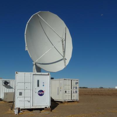
The NPOL underwent a complete antenna system upgrade in 2010 and is one of two fully transportable research-grade S-band systems in the world. It is used to make accurate volumetric measurements of precipitation including rainfall rate, particle size distributions, water contents and precipitation type.


Photo taken by Scott Collis of the of Argonne National Laboratory.
View Scott Collis' Flickr Page
View the ARM Flickr Page

Photo taken by Scott Collis of the of Argonne National Laboratory.
View Scott Collis' Flickr Page
View the ARM Flickr Page