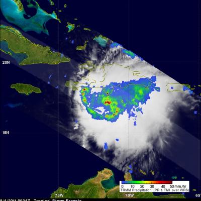
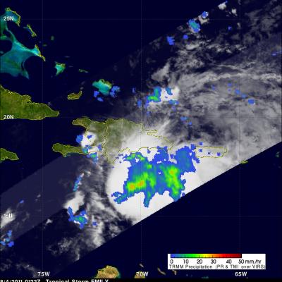
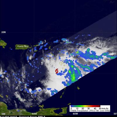
Tropical Storm Emily Rainfall
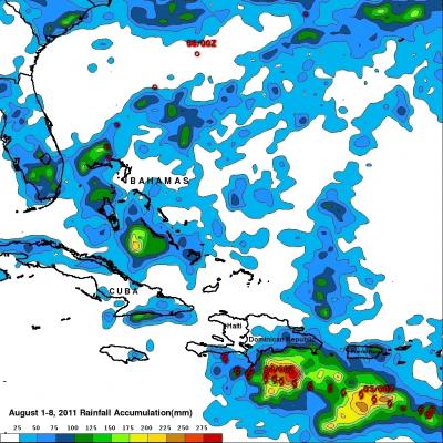
The TRMM-based, near-real time Multi-satellite Precipitation Analysis (TMPA) at the NASA Goddard Space Flight Center provides estimates of rainfall over the global Tropics. TMPA rainfall totals associated with tropical storm Emily are shown for the period from 1 to 8 August 2011. Approximate locations for Emily are shown with appropriate red symbols and the storm's 0000Z positions were labeled. The TMPA analysis above indicates that Emily dropped the heaviest rainfall totals of close to 300 mm (~11.8 inches) in the Caribbean Sea south of the Dominican Republic. Tropical storm Emily formed near