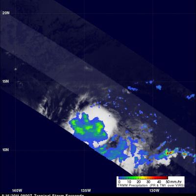
Colder Water Chills Fernanda
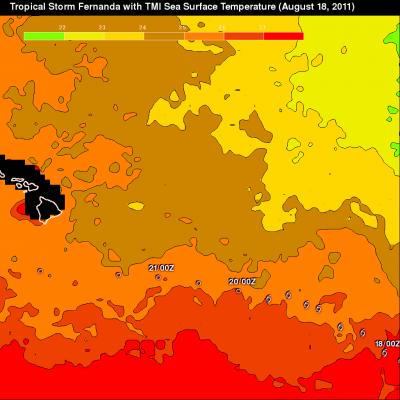
Ocean water warmer than 26C is a necessary condition for tropical cyclones to support convection. A TMI based Sea Surface Temperature (SST) analysis for three days ending on 18 August 2011 is shown above. Tropical Storm Fernanda's path (overlaid in white) recently took it over ocean waters colder than 26 Celcius so it has weakened considerably. The TRMM satellite passed over Fernanda on 19 August 2011 at 0648 UTC. The TMI and PR rainfall analysis from this pass shows that there is now very little rainfall with the weakening storm. See earlier news about Tropical Storm Fernanda