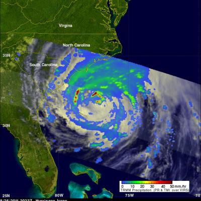
TRMM Views Irene Again Over Cape Hatteras
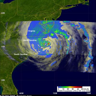
The TRMM satellite had another very good daytime view of hurricane Irene on 27 August 2011 1750 UTC (1:50 PM EDT). The rainfall analysis shown on the right was derived from TRMM's Microwave Imager (TMI) and Precipitation Radar (PR) data. It clearly shows the location of Irene's eye and the intense rainfall falling over Cape Hatteras east of the eye. Click here to see this image in Google Earth (kml).