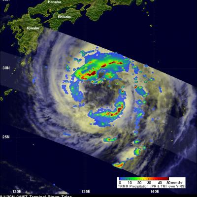
Two Tropical Cyclones Near Japan
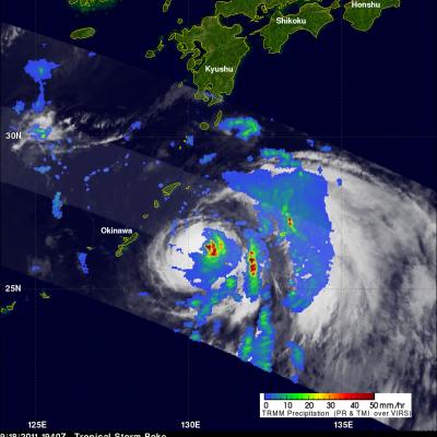
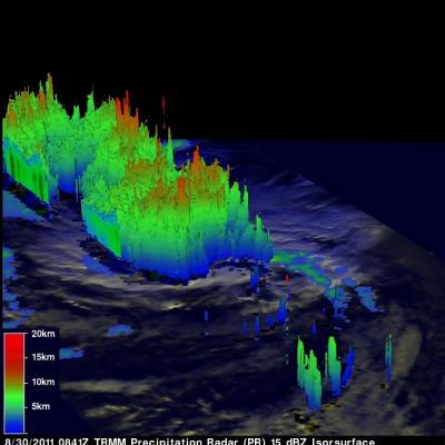
The TRMM satellite flew over two tropical cyclones near Japan on 18 September 2011. Typhoon Sonca, shown above, was seen off the east coast of the main Japanese island of Honshu at 1805 UTC while moving away from Japan toward the north-east. Sonca was still a powerful typhoon with wind speeds of about 85 knots (~98 mph) at that time but Sonca weakened to a tropical storm on 19 September 2011 while moving over the colder waters of the northern Pacific Ocean to the north-east of Japan. TRMM saw tropical storm Roke a little later at 1840 UTC. TRMM Precipitation Radar (PR) data shows that Roke