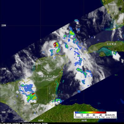
Tropical Storm Don Approaching Texas
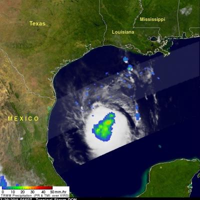
The TRMM satellite passed over tropical storm DON on 29 July 2011 at 0650 UTC (1:50 AM CDT) while the storm was in the Gulf Of Mexico. TRMM's Microwave Imager (TMI) data were used in the image on the right to show rainfall overlaid on an infrared image from TRMM's Visible and InfraRed Scanner (VIRS) instrument. This image shows that DON had become larger and better organized since last seen by TRMM. Also the area of rainfall was larger with some moderate to heavy rainfall located near the storm's center. Texas has been suffering from extreme drought this year so DON's rainfall may provide some