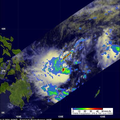
TRMM Examines Another Potential Tropical Cyclone
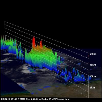
The Tropical Rainfall Measuring Mission (TRMM) satellite was placed into its low-earth orbit in November of 1997. Its primary mission has been to measure rainfall from space. TRMM has provided space borne rain radar and microwave radiometric data that measure the vertical and horizontal distribution of rainfall over the tropics. It has also been valuable for monitoring the development of tropical cyclones, especially over remote parts of the open ocean. The image on the right uses data captured by the TRMM satellite on 7 April 2011 at 1914 UTC. It shows a TRMM satellite view of rain intensity