TRMM Sees Diminished CHERENO (18S)
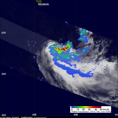
The TRMM satellite passed directly above the remnants of tropical cyclone CHERENO (18S) in the South Indian Ocean on 22 March 2011 at 0225 UTC. TRMM's Microwave Imager (TMI) and Precipitation Radar (PR) show that CHERENO, although weakened, still had some life and was producing very heavy rainfall of over 50 mm/hr (~2 inches) south-southeast of Reunion Island.