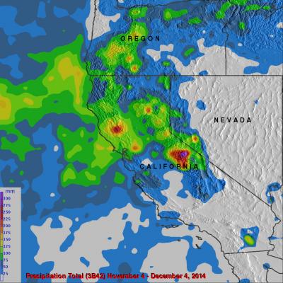
"Pineapple Express" Brings Heavy Rains, Flooding to U.S. West Coast
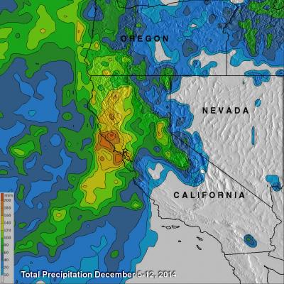
The West Coast, which has been suffering from a strong drought, is finally seeing some much needed relief as a steady stream of storms and rain pour into the coast from the Pacific. The rains began in Washington and Oregon and have now worked their way down the coast to southern California. The weather pattern responsible for all of the rain is known as the "Pineapple Express." The Pineapple Express is known as an atmospheric river. A large, slow-moving low pressure center off of the West Coast taps into tropical moisture originating around the Hawaiian Islands, which is then channeled