Goodbye to TRMM, First Rain Radar in Space
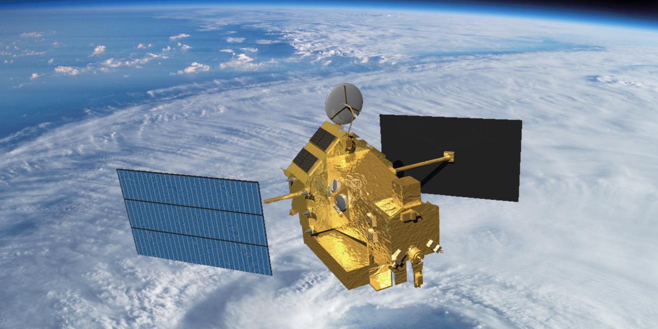
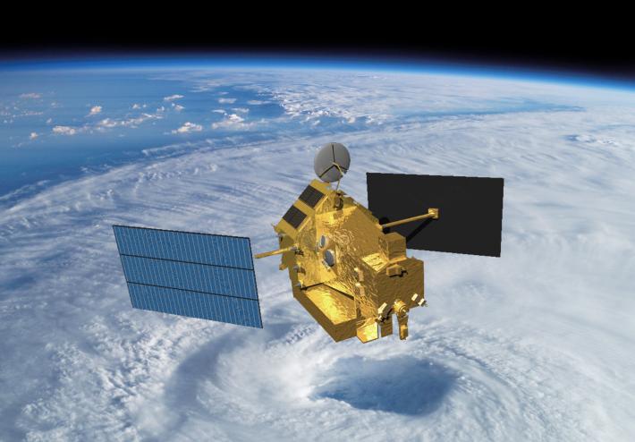
After 17 years of groundbreaking 3-D images of rain and storms, the joint NASA and Japan Aerospace Exploration Agency Tropical Rainfall Measuring Mission (TRMM) will come to an end next year. NASA predicts that science operations will cease in or about April 2015, based on the most recent analysis by mission operations at NASA’s Goddard Space Flight Center, Greenbelt, Maryland.
On July 8, 2014, pressure readings from the fuel tank indicated that TRMM was near the end of its fuel supply. As a result, NASA ceased station-keeping maneuvers that would keep the satellite at its operating altitude of 402 km (249.8 miles). Atmospheric drag is slowing TRMM, and it has begun its slow drift downward. Some fuel has been retained to conduct debris avoidance maneuvers to ensure the satellite remains safe during the drift down to re-entry, which is predicted to occur in the summer of 2015.
Originally launched in 1997 as a three-year mission, TRMM's extended mission life has provided a boon to the scientific understanding of precipitation and its role in broad weather patterns and climate. TRMM has allowed scientists to better understand how rain varies daily, seasonally and annually; how El Niño affects global rain patterns; how regional rain events like the Indian monsoon vary throughout the season; and even how humans have affected local precipitation through the effects of urban heat islands, deforestation and pollution.
Credit: NASA's Goddard Space Flight Center
Download video in HD format from NASA Goddard's Scientific Visualization Studio
"TRMM has been the world’s foremost satellite for the study of precipitation and climate processes in the tropics, and an invaluable resource for tropical cyclone research and operations," says TRMM Project Scientist Scott Braun at NASA Goddard. "Data from TRMM will continue to foster science well after the mission ends, and, when combined with data from the new Global Precipitation Measurement Core Observatory (GPM), launched earlier this year by NASA’s partner the Japan Aerospace Exploration Agency (JAXA), will contribute to a long-term precipitation climate record.”
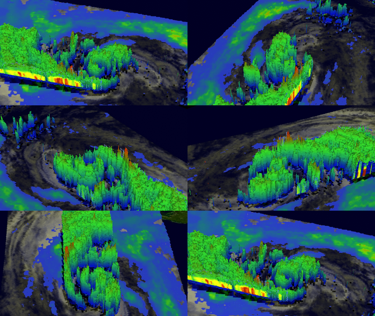
Orbiting at an angle to the equator that covers 35 degrees north to 35 degrees south of the equator, TRMM carries five instruments that collectively measure the intensity of rainfall, characteristics of the water vapor and clouds, and lightning associated with the rain events. One of the instruments, the Precipitation Radar, built by JAXA, is the first precipitation radar flown in space. It returns images of storms that for the first time have revealed close-up, 3-D views of how rain bands in tropical cyclones develop, potentially indicating how strong the storms might become.
Pulses of microwave radiation from the TRMM Precipitation Radar penetrate clouds to see raindrops and precipitation-sized ice such as hail. The radar's ability to make precise measurements of both the altitude and the intensity of precipitation gives scientists clues about the energy that fuels thunderstorms, hurricanes and other kinds of severe weather. The deepest and most intense thunderstorms have the potential to generate surface rainfall that may briefly exceed a rate of 100 millimeters (3.9 inches) per hour, and to generate hail, lightning and occasionally tornadoes.
Another key instrument is the TRMM Microwave Imager, or TMI, that provides images of rainfall across a swath more than three times as wide as that from the radar. Data from TMI go into forecasts of tropical cyclones made by the National Hurricane Center, and maps used by emergency managers that show areas at risk of flooding after heavy rains.
 This 3-D image of Hurricane Sandy's rainfall was created using TRMM Precipitation Radar data. It shows the storm as it appeared on Oct. 28, 2012.
Credit: NASA/SSAI, Hal Pierce
More about Sandy from NASA
Because of how the Precipitation Radar works, science data is collected within narrow altitude ranges near 400 km (248.5 miles) and 350 km (217.5 miles). JAXA, which manages the Precipitation Radar data, recently stopped distribution of the radar data when TRMM fell below 392.5 km (243.9 miles) altitude. Observations will resume when the satellite nears 350 km (217.5 miles), which is estimated to be in February or March of 2015, allowing the collection of one more month of data before science operations stop.
The TMI and Lightning Imaging Sensor, another of TRMM’s instruments, will continue operating during the entire drift-down period, although TMI data will be affected. The angle at which TMI views Earth's surface will be changing as will the field of view. However, the science team expects data to continue to be useful for rain estimates, and tropical cyclone and flood monitoring and prediction.
After launch by JAXA on Feb. 28, 2014, the GPM Core Observatory began its prime mission on May 29, and will have more than a year of overlap with TRMM's data as the satellite descends. The Core Observatory continues and expands upon TRMM's capabilities, carrying an advanced GPM Microwave Imager and JAXA’s Dual-frequency Precipitation Radar.
The GPM Core Observatory's area of coverage extends beyond TRMM's coverage of the tropics as GPM provides coverage from the Arctic Circle to the Antarctic Circle. While this means fewer observations of the tropics, it also means that GPM will be able to observe hurricanes, like Sandy in 2012, that travel north (or south) farther into the mid-latitudes. GPM data is already in use to monitor tropical cyclones around the world by the Naval Research Laboratory. GPM will also be able to detect light rain and snowfall, a major source of available fresh water in some regions. The joint NASA-JAXA mission will study rain and snow around the world, joining with an international network of partner satellites to provide global precipitation datasets on half hourly and longer time scales.


