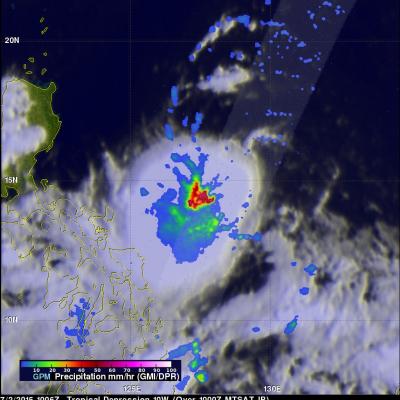
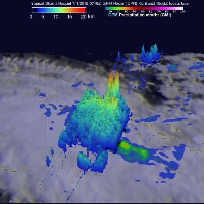
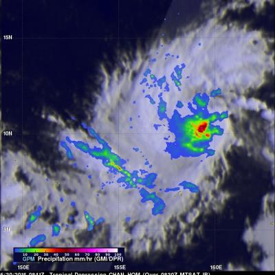
As predicted by the Joint Typhoon Warning Center (JTWC) typhoon Haiyan became a powerful category five typhoon with sustained winds estimated to be over 135kts (~155 mph). Super typhoon Haiyan is predicted to strike the central Philippines in a few days. Super typhoon Haiyan was located just northeast of Palau when the TRMM satellite flew above on November 6, 2013 at 1026 UTC. A rainfall analysis from TRMM's Microwave Imager (TMI) and Precipitation Radar (PR) instruments is shown overlaid on an enhanced infrared image from TRMM's Visible and InfraRed Scanner (VIRS). Data from TRMM's TMI and PR
The Joint Typhoon Warning Center (JTWC) predicts that typhoon HAIYAN (31W) that developed east of the Philippines will become dangerous super typhoon HAIYAN with winds of 130kts (~150mph) before it hits the southern Philippines in about three days. The TRMM satellite had a good daytime view when it flew above tropical storm HAIYAN (31W) yesterday evening on November 4, 2013 at 2353 UTC. This image shows precipitation data collected with TRMM's Microwave Imager (TMI) and Precipitation Radar (PR) instruments overlaid on a combination visible and infrared image from TRMM's Visible and InfraRed
On November 1, 2013 at 1320 UTC the TRMM satellite had the second look at typhoon KROSA. KROSA weakened slightly when it passed over the northern Philippines but had started to intensify with this second pass over the South China Sea. The image on the left shows rainfall data collected by TRMM's Microwave Imager (TMI) and Precipitation Radar (PR) instruments overlaid on an enhanced infrared image. TRMM PR data revealed that rain was falling at a rate of over 116mm/hr (4.5 inches) in KROSA's eye wall. Radar reflectivity values greater than 50dBZ were found in the same area. The 3-D perspective