Gillian's Persistent Remnants

The persistent remnants of tropical cyclone GILLIAN have moved westward over 2700km (about 1674 miles) since forming in the Gulf Of Carpentaria on March 8, 2014. GILLIAN's coherent remnants were located just to the southeast of the Indonesian island of Java when the TRMM satellite flew over on March 20, 2014 at 0415 UTC. TRMM's Precipitation Radar (PR) instrument revealed that intense convective storms in this area were still dropping rain at a rate of over 97 mm/hr (about 3.8 inches) and returning radar reflectivity values of over 51dBZ. TRMM PR data were used in the simulated 3-D view on the

Tropical Cyclone Gillian's Remnants

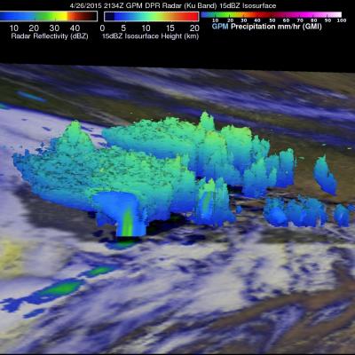
Over the past few days former tropical cyclone GILLIAN's remnants moved from the Gulf Of Carpentaria into the Timor sea . The TRMM satellite found a few strong convective thunderstorms when it passed above these remnants on March 18, 2014 at 0431 UTC. TRMM's Precipitation Radar (PR) instrument measured rain falling at a rate of over 86 mm/hr (~3.4 inches) in some intense storms. The simulated 3-D image above was made using TRMM PR data and shows that several of the tallest thunderstorms in GILLIAN's remnants were reaching heights of over 15.75 km (~9.8 miles). Radar reflectivity values of over

Tropical Cyclone Formation

The TRMM satellite flew above northern Australia on March 14, 2014 at 0500 UTC capturing data used in the image on the right. Very strong convective storms in this area are the remnants of tropical cyclone GILLIAN and may signal a rebirth. TRMM's Precipitation Radar (PR) instrument found rain falling at the rate of over 116 mm/hr (~4.5 inches) in these powerful storms in the northeastern Gulf Of Carpentaria. TRMM PR data were also used in this 3-D view of the strong convective storms in the northern Gulf Of Carpentaria. Some towering convective storms were found to be very energetic. Several

Calibrating Thrusters, Verifying Science Data

The Global Precipitation Measurement mission's Core Observatory is performing normally. On March 12, the GPM Core Observatory fired its thrusters for a 30-second check-out of their performance. The burn, called a delta-v, changes the velocity of the spacecraft to adjust the altitude of its orbit. This week's short maneuver did not greatly alter the satellite's orbit but was used instead for further calibration of the thrusters. Functional checkout activities and internal calibration of the Dual-frequency Precipitation Radar continued this week. Both DPR and the GPM Microwave Imager have begun

Deadly Tropical Cyclone Lusi

Tropical cyclone LUSI recently caused the deaths of at least three people as it moved through the island nation of Vanuatu in the South Pacific Ocean. The TRMM satellite flew above tropical cyclone LUSI on March 12, 2014 at 0342 UTC. A rainfall analysis made from TRMM's Microwave Imager (TMI) and Precipitation Radar (PR) data is shown overlaid on an enhanced visible/infrared image from TRMM's Visible and InfraRed Scanner (VIRS). TRMM PR data revealed with this analysis that rain was falling at a rate of over 97 mm/hr (~3.8 inches) in rain bands rotating around LUSI's center. TRMM's