GPM Core Installed into Rocket Fairing

On Feb. 11, the Core Observatory was moved into the spacecraft fairing assembly building and into the Encapsulation Hall. Final inspections and preparations were completed for the installation into the fairing, which began on Feb 13. The fairing is the part of the rocket that will contain the spacecraft at the top of the H-IIA rocket. The encapsulation process for the H-IIA is very different than for most U.S. rockets. For U.S. rockets, the fairing is usually in two pieces that close around the payload like a clamshell. To install the GPM Core Observatory into the fairing of the H-IIA rocket

Tropical Cyclone Fobane

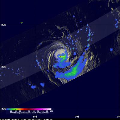
Tropical cyclone Fobane was located southeast of Reunion Island in the southwest Indian Ocean when the TRMM satellite passed over on February 11, 2014 at 0035 UTC. Fobane was very small but contained a few powerful convective thunderstorms near the tropical cyclone's center of circulation. TRMM's Precipitation Radar (PR) measured rain falling at a rate of over 68mm/hr (~2.7 inches) in these storms. The image above shows a simulated 3-D view using data from TRMM's Precipitation Radar (PR) instrument. Those data found a few of the powerful storms near Fobane's center were reaching heights of

TRMM Visits Edilson Again

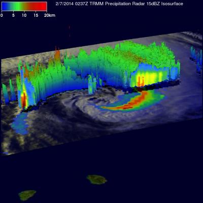
The TRMM satellite had an excellent early morning look at Edilson on February 7, 2014 at 0237 UTC (~ 0628 local time) when it passed directly above the tropical cyclone . A rainfall analysis from TRMM's Microwave Imager (TMI) and Precipitation Radar (PR) instruments is shown overlaid on an enhanced visible/infrared image from TRMM's Visible and InfraRed Scanner (VIRS). The area covered by TRMM's Precipitation radar (PR) data is shown in a lighter shade. Those data show Edilson south of Reunion and Mauritius Islands dropping it's heaviest rain at a rate of over 175mm/hr (~6.9 inches) in an

Tropical Cyclone Edilson Near Mauritius

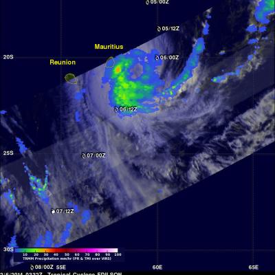
Tropical Cyclone Edilson was passing close to the islands of Mauritius and Reunion, in the south Indian Ocean, when the TRMM satellite flew above on February 6, 2014 at 0332 UTC. Rainfall from TRMM's Microwave Imager (TMI) and Precipitation Radar (PR) instruments is shown overlaid on an enhanced visible/infrared image from TRMM's Visible and InfraRed Scanner (VIRS). TRMM TMI data showed that moderate to heavy rain was falling at a rate of over 30mm/hr (about 1.1 inches) just to the southeast of Mauritius. With sustained winds of about 55kts (~63 mph), Edilson is much weaker than deadly

GPM Spacecraft Completes Fueling

The Global Precipitation Measurement mission propulsion team completed fueling the Core Observatory spacecraft on Feb. 6 in the spacecraft and fairing assembly building at the Japan Aerospace Exploration Agency's Tanegashima Space Center, Japan. Afterward the propulsion team did leak checks. GPM's fuel is hydrazine, which will power GPM's 12 thrusters that are used to maneuver the spacecraft so that it first enters then maintains its final orbit 253 miles (407 km) above Earth's surface. GPM will carry enough fuel for a minimum of five years of mission life.