
The 13 Channels of the GPM Microwave Imager (GMI)
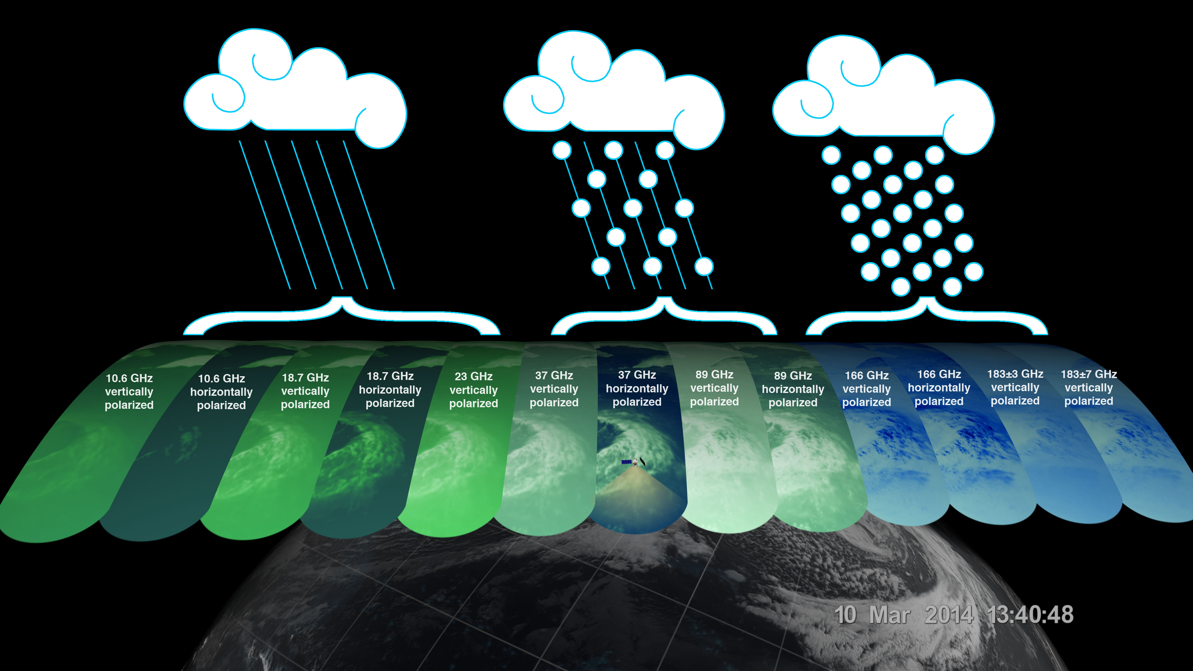
The GPM Microwave Imager (GMI) has a swath 550 miles (885 kilometers) wide, giving it a broad view of cyclones and other storm systems. The GMI instrument has 13 channels, each displayed in this visualization of the data. Each channel is sensitive to a different frequency of microwave energy naturally emitted from or affected by precipitation. As depicted by the graphic, the five channels on the left are sensitive to heavy and moderate rainfall. The four channels in the center sense precipitation mixtures of both snow and ice within the clouds. The mixed layers are often the result of ice or snow melting into rain as it falls. The four channels on the right are sensitive to water vapor and snowfall. Multiple channels in each category ensure that GMI captures as full a range as possible of precipitation types.
The data from GMI is used as a reference standard for an international network of partner precipitation-measuring satellites known as the GPM Constellation. The data from the GPM Core Observatory and these partner satellites are unified into a single global precipitation dataset called IMERG, which is updated every three hours.