United States

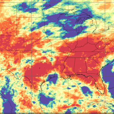
IMERG Sees a Dry September
Rainfall was scarce across much of the country in the month of September, pushing the eastern and southern thirds of the country into drought conditions. IMERG, the Integrated Multi-satellitE Retrievals for GPM, is a unified satellite precipitation product produced by NASA to estimate surface precipitation over most of the globe.

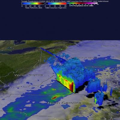
GPM Examines Violent Thunderstorms in U.S.

Severe weather moved through the southern U.S. on February 2 and 3, and NASA's Global Precipitation Measurement or GPM core satellite examined the violent thunderstorms. On February 3, 2016 at 1851 UTC (1:51 p.m. EST) the GPM core observatory satellite flew over a line of storms extending from the Gulf coast of Florida through New York state. Tornadoes were spotted in Georgia and South Carolina within this area of violent weather. GPM's Microwave Imager (GMI) and Dual-frequency Precipitation Radar (DPR) instruments measured the precipitation within the area. As the satellite passed above, GPM

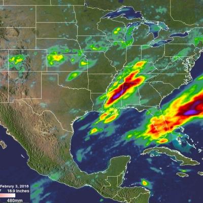
Extreme Precipitation Measured From Space

For over a week the weather over the continental United State's has been punctuated by extreme events. Automobiles were thrown around on January 27, 2016 by tornadoes that hit southern Florida. On January 31 a winter storm with heavy rain, strong winds and isolated thunderstorms hit southern California killing at least one person. There were numerous reports of hail with these storms ranging from pea sized to up to an inch in diameter. Powerful winds with these storms also brought down trees and power lines. A blizzard that followed the Democratic and Republican caucuses in Iowa dropped over