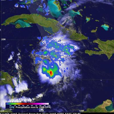
GPM Sees Towering Thunderstorms In Intensifying Tropical Storm Earl
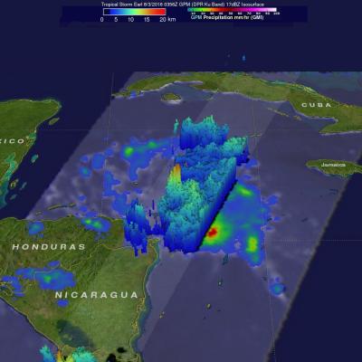
Tropical storm Earl has been intensifying as it moves through the Caribbean Sea. The National Hurricane Center (NHC) now predicts that Earl will be a hurricane before it hits Mexico's Yucatan Peninsula tomorrow afternoon. Earl is predicted by NHC to remain in a light to moderate vertical wind shear environment over very warm sea surface temperatures until landfall. The GPM core observatory satellite passed over intensifying tropical storm Earl in the Caribbean Sea northeast of Honduras on August 3, 2016 at 0356 UTC ( August 2, 2016 11:56 PM EDT). GPM's Microwave Imager (GMI) and Dual-Frequency