wildfires

Alaska Rainfall 2019 and 2020
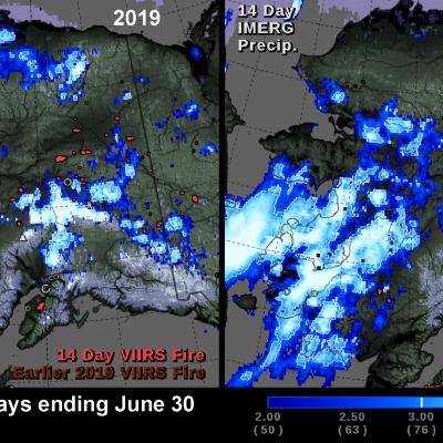
NASA's multi-satellite precipitation algorithm, known as IMERG , is a tool that can help us understand recent fluctuations in Alaska's wildfires. In the summer of 2020, wildfires burned fewer acres in Alaska than in any other year during the past 10 years. In contrast, wildfires burned a record number of acres in Alaska in the summer of 2019. The image below shows the locations of satellite-detected fires and precipitation during the last two weeks of June for both years. The above image shows IMERG rainfall totals overlaid with fire hot spot detections from the Visible Infrared Imaging

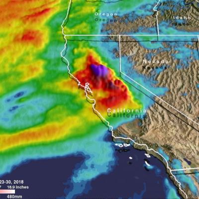
IMERG Measures Flooding Rainfall In Deadly California Wildfire Areas

Heavy precipitation has been falling in areas of California that were recently devastated by deadly wildfires. This flooding rainfall has resulted in evacuations in burn scarred areas such as Butte County where the deadly Camp Fire hit this month. Flash floods, debris flows and mudslides are now predicted in areas where deadly wildfires stripped away vegetation. On a positive note these Pacific storms are expected to dampen wildfires and replenish the Sierra Nevada snowpack. This snowpack is an important source of water for California's streams and rivers. NASA's Integrated Multi-satellitE
NASA Rainfall Data and Global Fire Weather
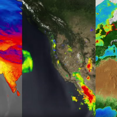
The Global Fire WEather Database (GFWED) integrates different weather factors influencing the likelihood of a vegetation fire starting and spreading. It is based on the Fire Weather Index (FWI) System, which tracks the dryness of three general fuel classes, and the potential behavior of a fire if it were to start. Each day, FWI values are calculated from global weather data, including satellite rainfall data from the Global Precipitation Measurement (GPM) mission.