Ecology

Ecological management is critical for maintaining and repairing ecological systems so the systems reliably supply human needs while conserving and sustaining ecological services and diversity. Satellite observations can provide critical information relevant to the distribution of ecosystems and their resident species. Natural resource managers and scientists use this information to understand patterns of biodiversity, how biodiversity is changing, drivers of changes, and to predict impacts of environmental changes on ecological systems. The Ecological Management Applications area encourages the use of satellite precipitation data from the GPM constellation to analyze and forecast changes that affect ecosystems and to develop effective resource management strategies.

GPM 10-in-10 Webinar Series Banner showing a placid lake with many birds on it.
April 11, 2024, 8 p.m. ET Register Here Overview With Earth Day coming up on April 22, we would like to share the many ways in which NASA and its partners help us to better understand and protect Earth. Join us on April 11 from 8 to 9 p.m. ET for an informative webinar. Guest speakers include Dr. Dalia Kirschbaum, Amy Chen, Liz Saccoccia, Matt Pearce, and Dorian Janney Speakers Liz Saccoccia Liz Saccoccia is a Water Security Associate on the World Resources Institute’s Water Team. She works with governments, companies, and research partners to advance best practices in water resources
World Resources Institute Ethiopia
NASA’s Earth observation data are used in a wide variety of ways to improve life for humans and other animals across the world every day. Our climate is changing, and these changes include differences in temperature and precipitation patterns around the globe. As you might imagine, these changes bring about both anticipated and unanticipated consequences that have a profound impact on people around the world. Many organizations are responding to the amazing yet complicated wealth of data that can be used to successfully monitor many aspects of our global environment. The World Resources
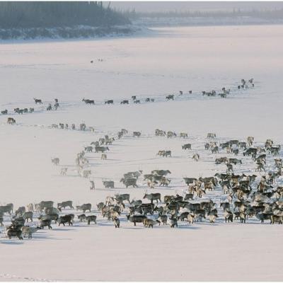
Caribou herd in the Yukon
Climate change increases need for global data The impacts of climate change are already having a profound effect on ecosystems. Changes in temperature and precipitation patterns affect species and communities in diverse ways, such as declines in species and species diversity, changing interactions between species, and modification of ecosystems. Effective ecosystem management is critical to maintaining and repairing the natural environments in order to reliably support human needs while conserving and sustaining ecological services and diversity. Imagine how a scientist studying the movement
Water next to a desert.
So Much Data, So Little Time NASA’s Earth-observing data are used daily in a wide variety of ways to improve life for humans and animals across the planet. Our climate is changing, and these changes are having a profound impact on communities and species in many ways. Changing extremes in precipitation and temperature are leading to a decline in species diversity, modification to ecosystems and animal habitats, as well as changing how some species interact with each other. To address this, many organizations are turning to the amazing yet complex wealth of Earth data, which can be used to
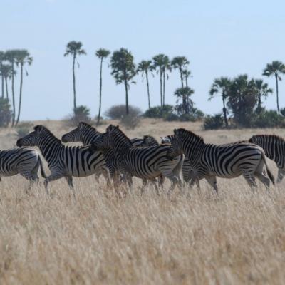
NASA satellites used to predict zebra migrations
Of stars and stripes: NASA satellites used to predict zebra migrations One of the world's longest migrations of zebras occurs in the African nation of Botswana, but predicting when and where zebras will move has not been possible until now. Using NASA rain and vegetation data, researchers can track when and where arid lands begin to green, and for the first time anticipate if zebras will make the trek or, if the animals find poor conditions en route, understand why they will turn back. Covering an area of approximately 8,500 square miles (22,000 square kilometers), Botswana’s Okavango Delta is...
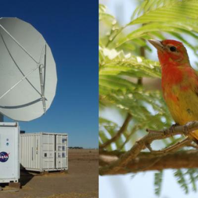
The NPOL radar and a Summer Tanger
By Ellen Gray , NASA Goddard Space Flight Center Original www.nasa.gov Press Release (published 6/7/12) NASA and Nature Conservancy Agreement Supports [no-glossary]Precipitation[/no-glossary] and Migratory Bird Research The NASA NPOL radar is a research grade S-band, scanning dual-polarimetric radar. It underwent a complete antenna system upgrade in 2010 and is one of two fully transportable research-grade S-band systems in the world. It is used to make accurate volumetric measurements of precipitation including rainfall rate, particle size distributions, water contents and precipitation type...