
Disasters

Determining where, when, and how natural hazards may vary and affect people at the global scale is fundamental to formulating mitigation strategies, appropriate and timely responses, and robust recovery plans. Specifically, NASA near-real-time precipitation estimates are used for regional assessments of current and potential wildfires and landslide activity.
GPM Provides a Closer Look at the Louisiana Floods
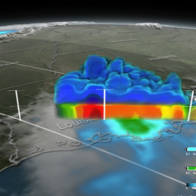
Twice on August 12, 2016 GPM flew over a massive rainstorm that flooded large portions of Louisiana. The flooding was some of the worst ever in the state, resulting in a state of emergency. Tens of thousands of people were evacuated from their homes in the wake of this unprecedented event. Throughout the course of August 12 (UTC) GPM captured the internal structure of the storm twice and GPM IMERG measured the rainfall accumulation on the ground. NASA's GPM satellite is designed to measure rainfall using both passive microwave (GMI) and radar (DPR) instruments. DPR can observe 3D structures of...
http://earthobservatory.nasa.gov/IOTD/view.php?id=88319
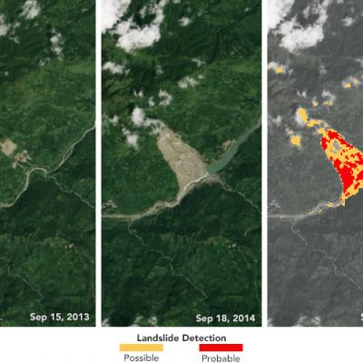
As farmers in Nepal prepare for the benefits of monsoon season, Dalia Kirschbaum anticipates the dangers of those torrential rains—mainly, the loosening of earth on steep slopes that can lead to landslides. In this mountainous country, 60 to 80 percent of the annual precipitation falls during the monsoon (roughly June to August). That’s when roughly 90 percent of Nepal’s landslide fatalities also occur, according to a 2015 report from the United Nations Office for the Coordination of Humanitarian Affairs. “We know a high number of landslides occur around this time, so documenting them is...
Rainfall Floods the Mississippi River
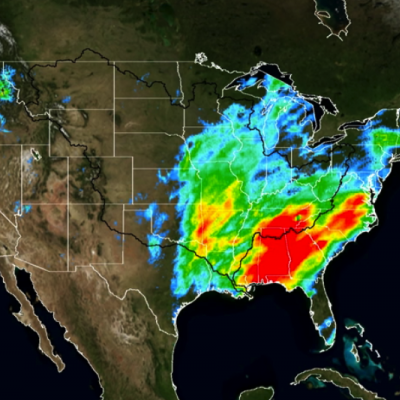
A series of winter storms brought more than 20 inches of rainfall to the Midwest and southeastern United States in December 2015. Massive flooding followed throughout both the regions. An animation of rainfall data from those storms was created at NASA's Goddard Space Flight Center in Greenbelt, Maryland. This animation shows the accumulation of rainfall over the United Stated during December 2015, from the IMERG precipitation dataset. The black outline indicates the Mississippi-Missouri River basin. This version has been edited to only show the periods of significant rainfall during the month...
NASA Aids Response to Carolina Flooding
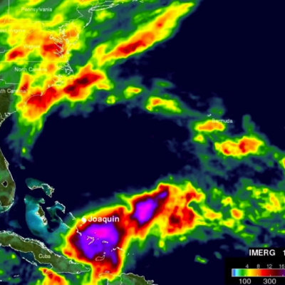
It was rain that wouldn't quit. A weather system fueled by warm moisture streaming in from the Atlantic Ocean on Oct. 3 and 4 relentlessly dumped between one and two feet of rain across most of South Carolina. The result was rivers topping their banks and dams bursting. Catastrophic flooding followed across most of the state, which has left residents in some areas without power or clean drinking water. Tracking and predicting the deluge, both as rain and then floodwater, are the first steps to help protect people in harm's way. State and federal emergency managers have been on the front lines...
Satellite-Based Flood Monitoring Central to Relief Agencies' Disaster Response
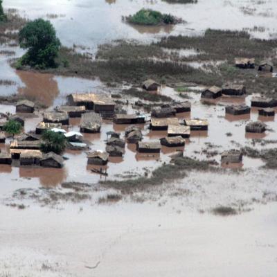
In January 2015, the Shire River in Malawi, and Zambezi River in Mozambique were under tight scrutiny. Weeks of torrential rains led these and other rivers to burst their banks displacing 390,000 people across the region. In southern Malawi 220,000 acres of farmland were turned into a lake, cutting off roads and stranding thousands of people on patches of high ground. The flood was devastating for the country, but within 72 hours of it being declared an emergency the United Nations World Food Programme (WFP) was on the ground distributing food to residents. The quick response was supported by...