Data

MHS NOAA-19 Data Processing Stop (PPS Will Halt NOAA-19 1C and GPROF Data)

PPS will halt the NOAA-19 L1C and GPROF products for the time being due to problems with the input received. Indications are that the NOAA-19 MHS channel 2 has failed. The input data (MSPPS_ORB) used for producing the NOAA-19 MHS L1C product is flagging all the Ta as missing, and as a result the L1C and GPROF products for NOAA-19 have ceased. We will inform you when and if we have any new details or announcements. Thank you for your attention and patience during this time.
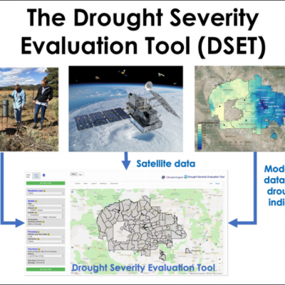
Using the IMERG Long-term Precipitation Data for Applications
A long precipitation data set like the new GPM IMERG V06 product is valuable for many applications and for decision-making. Accurate and reliable precipitation records are not only crucial to understanding trends and variability but also for water management resources and food security, ecological management, and weather, climate and hydrological forecasting. Here we present a few highlights showcasing how GPM IMERG is helping a variety of end users make decisions that will benefit society for years to come. GPM IMERG Data Used for Wind Energy Map of average precipitation in north-central...
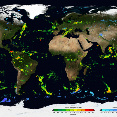
IMERG precipitation map from 11-6-19
This page provides a directory of download links, documentation, and other details about data products produced by NASA's Global Precipitation Measurement Mission (GPM) and Tropical Rainfall Measuring Mission (TRMM).
AGU24 Hyperwall
Beginner Training Sessions Overview of Global Precipitation Measurement (GPM) Mission, Data Products and Data Access Tools Topics Covered: Learn about the GPM Core Observatory satellite: Orbital Configuration, Sensors ( GMI, DPR) GPM Constellation Satellites Learn about GPM precipitation data products: Level-2 to Level-3 Data Sets from GMI, DPR and Combined GMI-DPR, IMERG Filename Conventions, Formats Spatial and Temporal Resolutions and Coverage Data Search and Access Web-tools Data Quality Potential Data Applications Training Resources: View a recording of the webinar Download the webinar
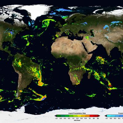
IMERG Early Run Example January 24th, 2020
Precipitation data from the GPM and TRMM missions are made available free to the public in a variety of formats from several sources at NASA Goddard Space Flight Center. This section outlines the different types of data available, the levels of processing, the sources to download the data, and some helpful tips for utilizing precipitation data in your research.

IMERG Real Time IR Outage

For the period 03Z August 21 to 16Z August 22, the IMERG real time system experienced an outage of CPC 4-km IR data. Despite the outage, IMERG EARLY and LATE products continued to be produced but users should be aware that the quality of these products during this period may be suspect and should be used judiciously. Furthermore, the products for the first few hours after the outage are less than optimal due to IMERG restart but should be acceptable for most users. Detailed Impacts: (1) The precipitation propagation vectors for the period slowly degraded after 03Z August 21 due to the missing

L1C NPP ATMS Data Product Version Update

L1C NPP ATMS intercalibration table has been updated to account for the NPP ATMS SDR calibration update occurred on March 8, 2017. As a result, PPS will change the L1C NPP ATMS product version to V05B. The downstream L2 - L3 product versions will also be advanced one letter from V05C to V05D. DataType ProductVersion Start of version End of version 1CNPPATMS V05A 2011-12-09 23:39:12 2018-08-19 22:54:33 2AGPROFNPPATMS V05C 2014-01-31 23:41:54 2018-08-19 22:54:33 3GPROFNPPATMS V05C 2014-02-01 00:00:00 2018-07-31 23:59:59 3GPROFNPPATMS_DAY V05C 2014-02-01 00:00:00 2018-08-18 23:59:59 Please let us

TKIO announcement - PPS Announcing a New tkio- 3.80.44 Release

PPS is releasing version 3.80.44 build of the PPS TKIO toolkit using the 14.0.1 Fortran compiler for GPM. As detailed in our earlier announcement that you received on Thursday, June 28th, 2018, titled; "PPS is Reprocessing TRMM PR Data as TRMM GPM, Version 06A HDF5 products in Early July 2018" This is the version of the PPS I/O Toolkit that will be used for these radar products. The release notes are in this directory and are also attached to this Email: ftp://gpmweb2.pps.eosdis.nasa.gov/pub/PPStoolkit/GPM/tkio-3.80.44/ The tar file can be found at: ftp://gpmweb2.pps.eosdis.nasa.gov/pub
Creating Digital Hurricanes
Every day, scientists at NASA work on creating better hurricanes – on a computer screen. At NASA’s Goddard Space Flight Center in Greenbelt, Maryland, a team of scientists spends its days incorporating millions of atmospheric observations, sophisticated graphic tools and lines of computer code to create computer models simulating the weather and climate conditions responsible for hurricanes. Scientists use these models to study the complex environment and structure of tropical storms and hurricanes. Getting the simulations right has huge societal implications, which is why one Goddard...
The Evolution of NASA Precipitation Data
NASA’s global precipitation data and data processing systems have come a long way from the launch of TRMM in 1997 to the ongoing GPM mission. Just before midnight Eastern Daylight Time on June 15, 2015, a fireball appeared over central Africa, streaked across Madagascar, and tracked across the uninhabited Southern Indian Ocean. This was the fiery end of the joint NASA/Japan Aerospace Exploration Agency (JAXA) Tropical Rainfall Measuring Mission (TRMM). TRMM’s homecoming after more than 17 years in orbit also marked the end of the first major satellite mission specifically designed to gather...