

Clouds and the Earth's Radiant Energy System (CERES)
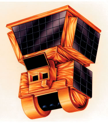
The CERES instrument
The Clouds and the Earth’s Radiant Energy System (CERES) instrument is one of five instruments that is being flown aboard the Tropical Rainfall Measuring Mission (TRMM) observatory. The data from the CERES instrument was used to study the energy exchanged between the Sun; the Earth’s atmosphere, surface and clouds; and space. However, it only operated during January - August of 1998, and March 2000, so the available data record is quite brief.
Balancing the Earth's Energy Budget
The Earth’s daily weather and climate are controlled by the balance between the amount of solar energy received by the Earth (both by its surface, and its atmosphere and clouds) and the amount of energy emitted by the Earth into space. Scientists have been working for decades to understand this critical energy balance - to understand the budget of incoming and outgoing energy, called the Earth’s radiation budget.
A major portion of the energy received from the Sun is at short wavelengths while the majority of energy emitted by the surface of the Earth and by clouds is at long wavelengths. Increases in the amounts of greenhouse gasses (gasses in the atmosphere that absorb the long wavelength energy emitted by the Earth) can lead to a warming of the Earth’s surface. Such changes may, in turn, cause changes in the Earth’s weather and climate. Some of the shortwave radiation from the Sun is also reflected back into space by clouds and small particles in the atmosphere called aerosols. Major sources of aerosols include windblown dust, emissions from the burning of fossil fuels such as gasoline, and the burning of forests and agricultural fields biomass burning).
Cloud Effects
One of the most intriguing questions facing climate modelers today is how clouds affect the Earth’s climate and vice versa. The U.S. Global Change Research Program classifies understanding the role of clouds and the Earth’s energy budget as its highest scientific priority. Understanding cloud effects requires a detailed knowledge of how clouds absorb and reflect incoming shortwave solar energy, as well as how they absorb and reemit outgoing longwave energy. For example, low, thick clouds primarily reflect incoming solar energy back to space causing cooling. Thin, high clouds, however, primarily trap outgoing longwave energy and produce warming. To date, satellite studies have found that clouds have an overall net cooling effect on the Earth.
Analysis of satellite data also has shown that clouds which form over water are very different from clouds which form over land. These differences affect the way clouds reflect sunlight back into space and how much longwave energy emitted by the Earth is absorbed by clouds and re-emitted. For example, over the equatorial Pacific Ocean during El Niño events, there is a significant decrease in the amount of energy emitted by the Earth due to increased cloudiness. El Niño events occur when portions of the Pacific Ocean become considerably warmer than normal. Clouds appear over the relatively warmer portions of the eastern Pacific and decrease over the relatively cooler western Pacific. These changes can affect weather patterns around the world.
Water Vapor Effects
Water vapor in the atmosphere also affects our daily weather and climate, though scientists are only beginning to understand how this complex mechanism works. Water vapor acts like a greenhouse gas, absorbing outgoing longwave energy. Because water vapor also condenses to make clouds, an increase in water vapor in the atmosphere also may increase the amount of clouds.
CERES components
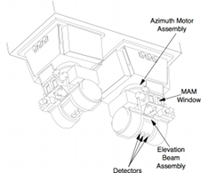
The CERES Instrument
The CERES instrument is based on NASA Langley’s highly successful Earth Radiation Budget Experiment which used three satellites to provide global energy budget measurements from 1984 to 1993.
CERES measured the energy at the top of the atmosphere, as well as estimate energy levels within the atmosphere and at the Earth’s surface. Using information from very high resolution cloud imaging instruments on the same spacecraft, CERES also determined cloud properties, including cloud-amount, altitude, thickness, and the size of the cloud particles. All of these measurements are critical for advancing our understanding of the Earth’s total climate system and further improving climate prediction models.
Five CERES instruments have been flown on multiple satellites starting with TRMM, followed the Earth Observing System (EOS)-AM satellite in 1998 and the EOS-PM satellite in 2000. Follow-up CERES satellite missions are planned to create a continuous 15-year history of highly accurate energy budget and cloud data for enhanced climate analysis.
Educational Outreach Programs
School children worldwide were involved in the CERES program, enabling them to be part of a scientific project. As a CERES instrument passes over, students will make local observations to determine the types of clouds over their school, the clouds’ altitudes and how much of the sky is covered by clouds. Via the Internet, the students will then place their data in the NASA Langley Distributed Active Archive Center where the data was stored for further analysis by the CERES science team.