
Satellite Data Empowers Farmers
Download this video from the NASA Goddard Scientific Visualization Studio
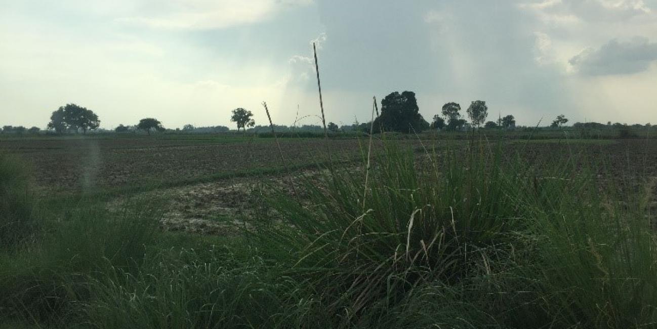
Today, India is among the world’s most water-scarce countries. This means that it does not have enough freshwater resources to meet the needs of all the people who live there. Mismanagement of water resources have largely contributed to the country’s limited water supplies. A growing competition over finite water resources will have serious implications for Indian farmers, as well as India’s food security. More than 70% of India’s population rely on agriculture as a source of livelihood. Even more so, an estimated 82% of the Indian farmers are reported as being small and marginal, according to the Food and Agriculture Organization of the United Nations. As such, these farmers generally own small plots of land and often grow enough food to feed themselves and their family. While many farmers depend on groundwater, canal water and rainwater as primary sources of irrigation, uncertainties in weather and irrigation water supplies and lack of reliable information on farm water requirements is resulting in inefficient watering practices consequently making farming unsustainable and contributing to India’s water-scarce issue.
Knowing when and how much to water crops can empower India’s struggling farmers and help conserve critical freshwater resources. That is what makes the University of Washington Civil and Environmental Engineering (UW CEE) program’s research so critical. The UW CEE research team, led by CEE professor Faisal Hossain, developed a technology-based irrigation advisory system to enable small farmers to receive irrigation information directly to their cellphones. This is called the PANI (Provision of Advisory for Necessary Irrigation) system. This application uses NASA Earth observations, such as precipitation data from the Global Precipitation Measurement (GPM) Mission, to help farmers make effective decisions to save water and make agriculture a more sustainable practice in India.
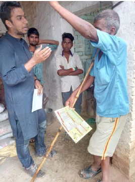 Interaction with marginal farmers in Uttar Pradesh for PANI piloting in 2018-2019. Credits: PANI Team and Faisal Hossain.
The PANI approach builds on the successful development of an operational irrigation advisory system in Pakistan that provides over 100,000 farmers with irrigation updates based on satellite and weather model data (Hossain et al., 2017). However, to address marginal farmers cultivating on small plots of land in India, additional technology was required to produce irrigation advisories on a hyperlocal scale and for a wide variety of crops.
PANI utilizes low-cost environmental monitoring ground sensors to collect information specific to each plot of land such as temperature, humidity and wind speed. The data is sent to low-power wide-area network gateway towers, which act as regional command centers and forward the information to a central database. The central database is populated with freely available satellite data (GPM) and weather model data (NOAA’s Numerical Weather Prediction system, Global Forecast System), along with geographic data about plot location and information collected from farmers about seed and fertilizer type. This combined information is used to generate irrigation advisories customized to each plot of land, which is communicated to farmers through text messages.
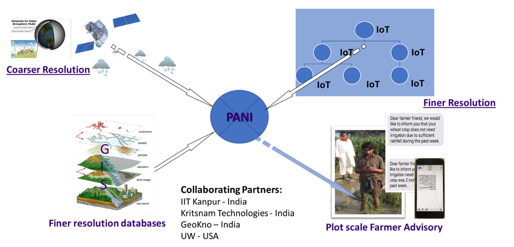
The PANI concept, combining satellite and weather model data (upper left) with finer resolution geographic data (lower left) and personalized farm data (upper right) to generate irrigation advisories in real-time via cellphones. Credits: PANI Team and Faisal Hossain.
One hundred and fifty farmers in northern India helped test this system from late 2018 through mid-2019. A feedback survey reported that 85% of the farmers benefitted from PANI, changing their irrigation habits based on messages received from the PANI app. As a result, PANI helped improve farmer’s expenditures, crop productivity and water usage.
The UW CEE research team aims to expand the user base throughout India, helping more farmers integrate the PANI system, integrate effective water use practices, and ultimately use NASA Earth observations into their daily lives.
The PANI project is a collaborative project between UW (USA), Indian Institute of Technology Kanpur (India), Kritsnam Technologies (India), and GeoKno (India).
Resources:
- GPM Earth Day 2020 Resources
- Learn more about the PANI system:
- Precipitation Education
- Who’s Using GPM Data?
- STEM Interview with Faisal Hossain
- Lesson Plans: Water for Wheaties? Freshwater Resources for Agriculture
- Explore more of the ways in which GPM Data are being used:
References:
- Food and Agriculture Organization of the United Nations, India: http://www.fao.org/india/fao-in-india/india-at-a-glance/en/
- Hossain, F., N. Biswas M. Ashraf and Z. Ahmad (2017). Growing more with less using cell phones and satellite data, Eos, vol. 98, https://doi.org/10.1029/2017EO075143
- The future of farming: https://www.ce.washington.edu/news/article/2018-08-30/future-farming
- Learn more about the PANI system: https://www.youtube.com/watch?v=ja-vEJ_JguE and https://www.youtube.com/watch?v=seKFUz8iMI4
Credits:
Text by Andrea Portier (NASA GSFC/SSAI)
Photos and images provided by Faisal Hossain, UW CEE.