Hurricane Irma's Heat Engine Exposed
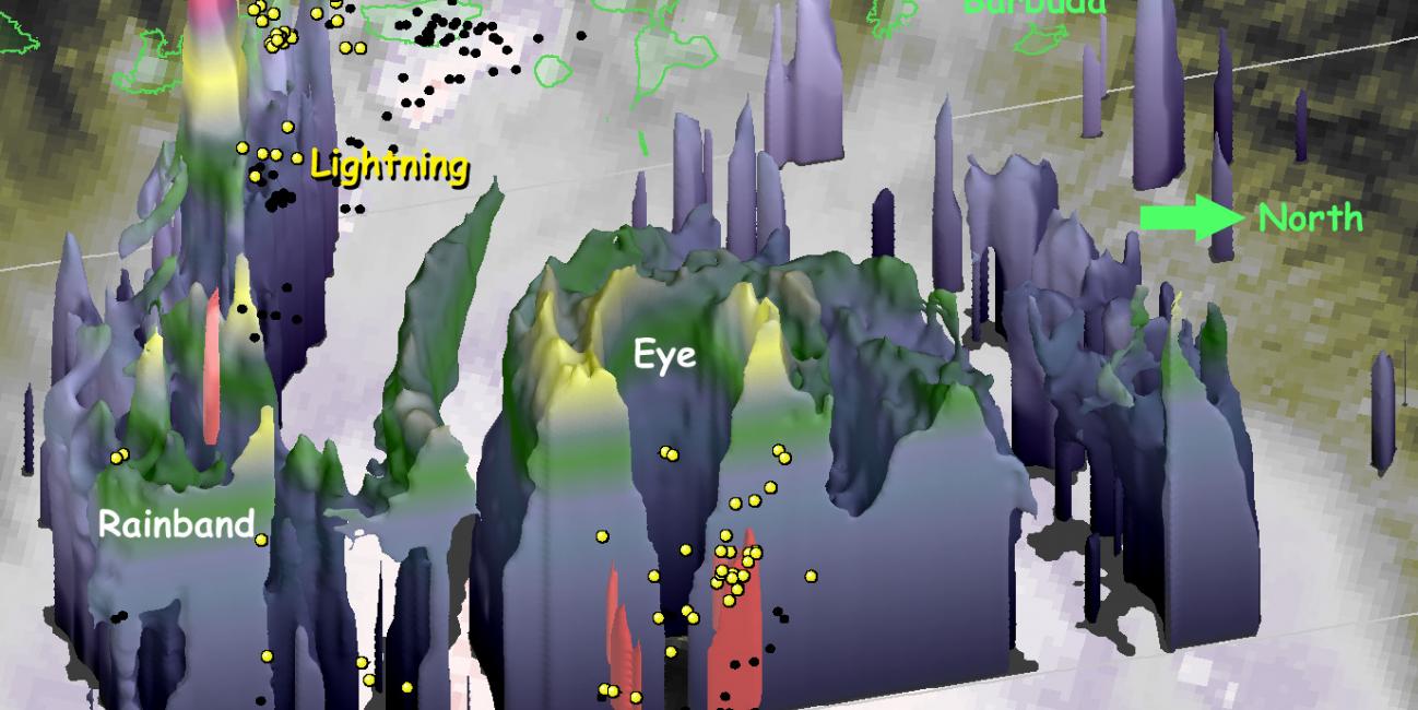
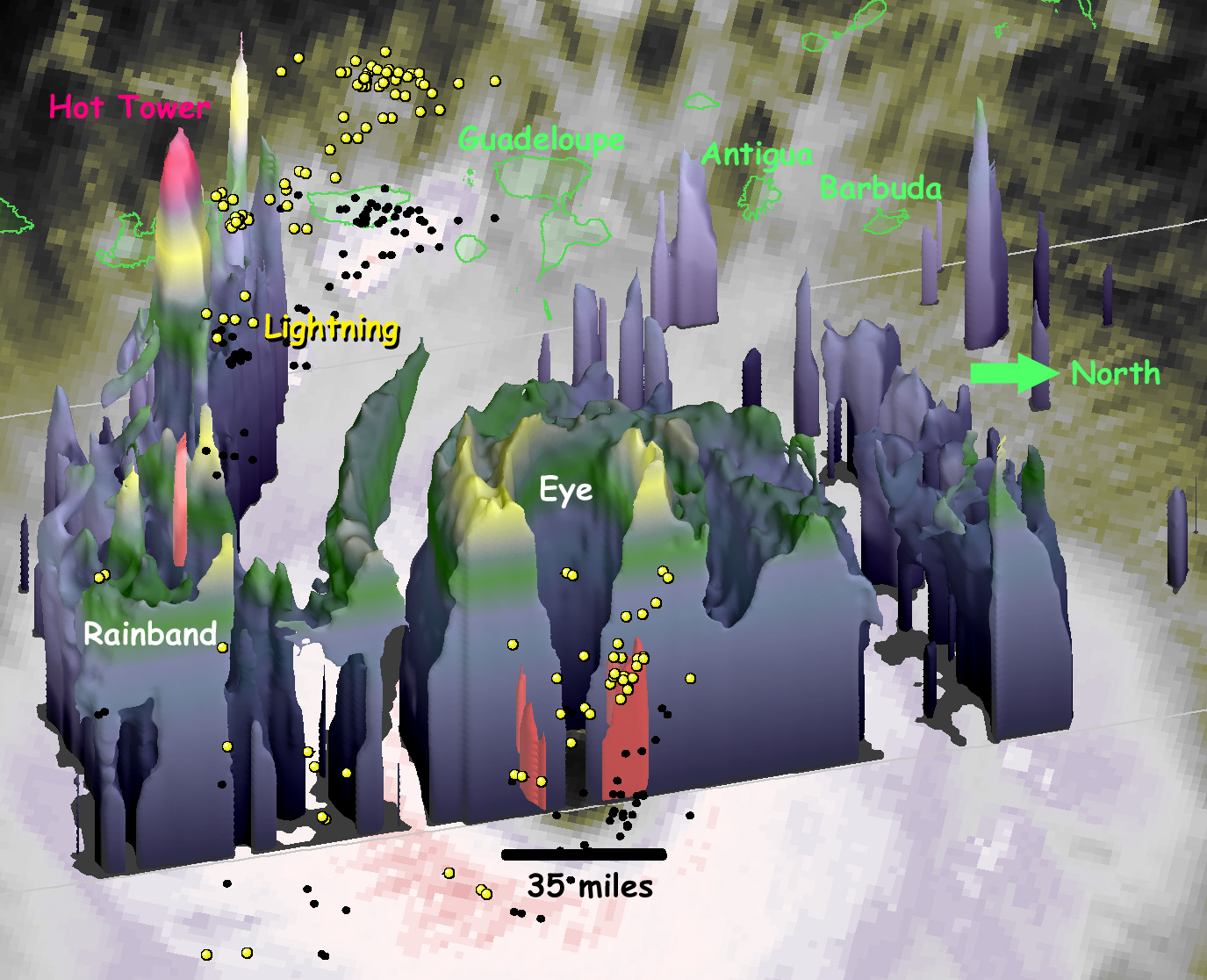
At 1 PM EDT (1700 UTC) on September 5, 2017, the radar on the Global Precipitation Measuring Mission (GPM) satellite captured this 3D view of the heat engine inside of category-5 Hurricane Irma. Under the central ring of clouds that circles the eye, water that had evaporated from the ocean surface condenses, releases heat, and powers the circling winds of the hurricane. The radar on the GPM satellite is able to estimate how much water is falling as precipitation inside of the hurricane, which serves as a guide to how much energy is being released inside the hurricane's central "heat engine."
The blue-gray 3D shape contains the light precipitation (corresponding to an observed 20-dBZ radar reflectivity), while the small, red 3D shapes at the base of the storm contain the heaviest precipitation (corresponding to an observed 50-dBZ radar reflectivity). A ring of updrafts just outside of the hurricane's eye lifts this precipitation to approximately a 12 kilometer altitude (yellow portion of the shaded volume).
A hot-tower storm cell in a rainband further from the eye has stronger updrafts that lift precipitation 14.5 km high (the bright violet portion of the 3D shape to the left of the eye in this image). This hot tower consumes some water vapor that would otherwise have helped to fuel the hurricane's winds. A single, hot tower is too small and short lived to have a noticeable effect on the hurricane's maximum sustained winds.
Confirming this radar analysis are lightning flashes observed by the World Wide Lightning Location Network (WWLLN). The lightning flashes were observed within 1 hour of the satellite radar observations. Each flash is indicated by a yellow sphere plotted at 5 km altitude. There is lightning in the ring of convection surrounding the eye, which indicates that Hurricane Irma's heat-engine is in high-gear. Lightning is also seen in the rainband that contains the hot tower (on the left side of the image).
To the west of Hurricane Irma (toward the top of the image) one can see some of the Leeward Islands, whose coastlines are indicates by green outlines. The GPM data in this image were provided by NASA and the Japan Aerospace Exploration Agency (JAXA).
Image by Owen Kelley of the NASA Goddard Precipitation Processing System.
Interactive visualization by Matt Lammers (KBRwyle / NASA GSFC)


