Aletta

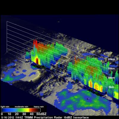
GPM Flies Over Intensifying Hurricane Aletta

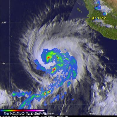
As expected, tropical storm Aletta intensified and became a hurricane. Aletta was a powerful hurricane with winds of about 85 kts (98 mph) when the GPM core observatory satellite passed over head on June 7, 2018 at 18:38 PM MDT (June 8, 2018 at 0038 UTC). GPM's Microwave Imager (GMI) and Dual Frequency Precipitation Radar (DPR) instruments showed that hurricane Aletta contained powerful storms that were producing heavy precipitation. Very strong convective storms were producing heavy rainfall in Aletta's eye wall while the most extreme downpours were shown in a large feeder band wrapping

Tropical Storm Aletta Forms In Eastern Pacific

Early today Tropical Depression Two-E was upgraded to tropical storm Aletta. This is the first tropical storm of the 2018 eastern North Pacific season. Aletta was located well southwest of Mexico. The National Hurricane Center (NHC) predicts that Aletta will become a hurricane tomorrow as it moves westward over the open waters of the eastern North Pacific ocean. The GPM core observatory satellite passed above developing tropical storm Aletta on June 6, 2018 at 0046 UTC. This image shows precipitation measurements that were calculated from data collected by GPM's Microwave Imager (GMI) and Dual

TRMM Sees Disorganized Aletta

The TRMM satellite passed almost directly above tropical storm Aletta in the eastern Pacific Ocean on 16 March 2012 at 1146 UTC. Data from TRMM's Microwave Imager (TMI) and Precipitation Radar (PR) instruments were used in the rainfall analysis shown above. Aletta's past and future positions are shown overlaid in white. Aletta looks disorganized in this orbit but some very heavy thunderstorms, producing rainfall at a rate greater than 50mm/hr (~2 inches), were located near the storm's center. TRMM's Precipitation Radar (PR) found that some thunderstorms contained very heavy rainfall with a

Tropical Storm Aletta Forms

The eastern Pacific hurricane season starts today. Just slightly ahead of schedule tropical storm Aletta formed yesterday well to the southwest of the Mexican coast. The image above uses data captured when the TRMM satellite passed above Aletta on 15 May 2012 at 0253 UTC. TRMM's Microwave Imager (TMI) instrument had a good look at the newly formed storm and showed that Aletta had a large area of light to moderate rainfall north of the storm's center of circulation. The TMI rainfall analysis is shown overlaid on an enhanced infrared image from TRMM's Visible and InfraRed Scanner (VIRS)