Bejisa

Reunion Island Hit Hard By Tropical Cyclone Bejisa

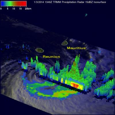
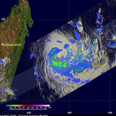
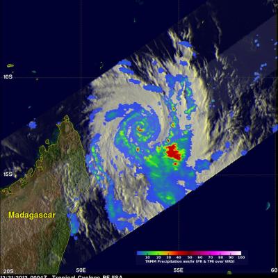
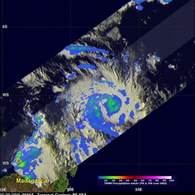
Bejisa's eye passed very close to the West of the French island of Reunion yesterday when maximum sustained winds were estimated to be 105 kts (~121 mph). Bejisa spawned wave heights of 8 meters (~26 feet), caused several serious injuries and extensive power outages. The TRMM satellite had a daytime view of Bejisa today at 1348 UTC after the tropical cyclone's sustained wind speeds had decreased to less than 60kts (~69 mph). Bejisa's past positions are shown overlaid in red on a rainfall analysis made from TRMM Microwave Imager (TMI) and Precipitation Radar (PR) data collected with this pass

Tropical Cyclone Bejisa Shown Menacing Reunion

Extremely powerful tropical cyclone Bejisa has passed just to the west of the French island of Reunion in the southwest Indian Ocean. Bejisa's forward speed and very powerful winds within the tropical cyclone made this a dangerous location for Reunion. Bejisa was moving toward Reunion when the TRMM satellite had an excellent view on January 1, 2014 at 2212 UTC. Bejisa had sustained winds estimated to be over 105kts (~121 mph) at the time of this pass making it equivalent to a category three hurricane on the Saffir–Simpson hurricane wind scale. A rainfall analysis that used data from TRMM's

TRMM Sees More Powerful Bejisa

The TRMM satellite had an excellent view of intensifying tropical cyclone Bejisa northeast of Madagascar on December 31, 2013 at 0004 UTC. As expected, Bejisa became more powerful and had maximum sustained wind speeds estimated at 105 kts (~121 mph) when TRMM flew over. A rainfall analysis from TRMM's Microwave Imager (TMI) and Precipitation Radar (PR) instruments is shown overlaid on an enhanced infrared image from the Visible and InfraRed Scanner (VIRS). Extremely heavy rainfall in Bejisa's eye wall returned reflectivity values greater than 55dBZ to the Precipitation Radar (PR) instrument

Tropical Cyclone Bejisa Near Madagascar

A tropical cyclone called Bejisa formed in the South Indian Ocean north-northeast of Madagascar on December 29, 2013 . The TRMM satellite flew over on December 30, 2013 at 0059 UTC. The image on the left shows a TRMM rainfall analysis for intensifying tropical cyclone Bejisa at that time when sustained winds were estimated to be greater than 60 kts (~69 mph). Data collected with TRMM's Microwave Imager (TMI) instrument provided better coverage of rainfall with this TRMM pass than the Precipitation Radar (PR) instrument that traveled to the northwest of Bejisa's center. The image on the right