Florida

TRMM Sees Tornadic Thunderstorms

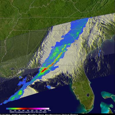
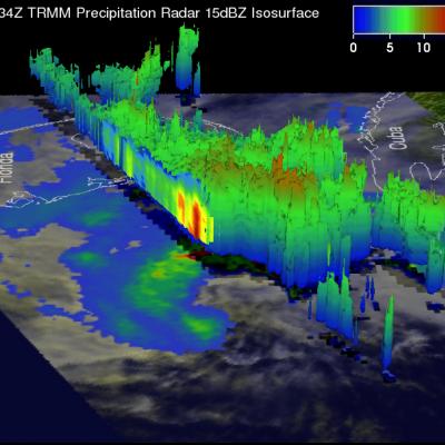
The TRMM satellite passed above a line of severe thunderstorms over the eastern United States on February 21, 2014 at about 1148UTC (6:48 AM EST). Several reports of tornadoes in Illinois were associated with this system yesterday. A possible tornado was reported in Georgia this morning. The 3-D image below shows a TRMM Precipitation Radar (PR) slice through the line of severe thunderstorms. One tall thunderstorm in the Florida panhandle was shown reaching heights of about 13.8km (~8.5 miles) and returning Radar reflectivity values of over 58dBZ to the satellite. Rain was found by TRMM PR to

TRMM Views Of Tropical Storm Andrea

The TRMM satellite satellite flew directly above tropical storm Andrea on Wednesday June 5, 2013 at 2234 UTC (6:34 PM EDT) and received data used in the image on the left. These data were captured just over an hour after the National Hurricane Center (NHC) named tropical storm Andrea. A rainfall analysis from TRMM's Microwave Imager (TMI) and Precipitation Radar (PR) instruments shows that moderate to heavy rain was wrapping around the eastern side of the storm. The heaviest rainfall of 124.5 mm/hr (~4.9 inches) from TRMM PR data was found on Andrea's southeast side. TRMM had another fairly

Tropical Storm Debby Drenches Florida

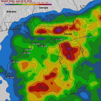
Even though it never became more than a tropical storm, the residents of northern and central Florida will remember Debby. Debby, which formed as a tropical storm on the 23rd of June 2012 in the central Gulf of Mexico, took three full days to reach the Big Bend of Florida just 350 miles away. Although the center didn't make landfall until around 5 pm on the afternoon of the 26th when it crossed the coast near Steinhatchee, Florida, Debby's effects were felt well away from the center. Most of the rain and weather associated with Debby were well to the north and east of the center over Florida

Tropical Storm Debby Threatens Florida Gulf Coast

Tropical Storm Debby formed on the 23rd of June 2012 in the central Gulf of Mexico, becoming the earliest 4th named storm on record. Debby began as an area of low pressure that moved out of the northwestern Caribbean and into the Gulf. After forming on the afternoon of the 23rd, Debby has moved very slowly under the influence of weak steering currents. Debby drifted ever so slowly northward on the night of the 23rd before turning northeast later on the morning of the 24th towards the northeast Gulf Coast of Florida. Despite its slow forward progress and lack of intensification, Debby has

Tropical Storm Debby

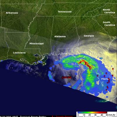
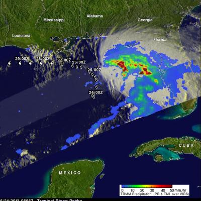
The TRMM satellite traveled directly above tropical storm Debby's location early this morning at 0656 UTC ( 2:56 AM EDT). TRMM Microwave Imager (TMI) and Precipitation Radar (PR) data from that pass shows that Debby was dropping heavy rainfall in a large area on the eastern side of the Gulf Of Mexico. Most of the powerful convective storms producing this rainfall are shown by TRMM to be located well to the northeast of Debby's center of circulation. A forecast track from the National Hurricane Center (NHC) was overlaid on the image above. It shows that Debby is expected to stengthen and travel

Tropical Depression Beryl Drenches Florida And Georgia

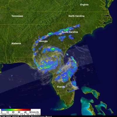
At times Tropical storm beryl has been producing intense rainfall over the southeastern United States since coming ashore early on Monday May 28, 2012. The TRMM satellite had good views of Beryl's rainfall on Monday May 28, 2012 at 2033 UTC (4:33 PM EDT) and on Tuesday May 29, 2012 at 0127 UTC (Monday May, 28 2012 at 9:27 PM EDT). Data from TRMM's Microwave Imager (TMI) and Precipitation Radar (PR) are shown in two images from those orbits. These TRMM images show that bands of rainfall rotating around Beryl were mainly affecting only northern Florida and southeastern Georgia. A few areas of