Francisco

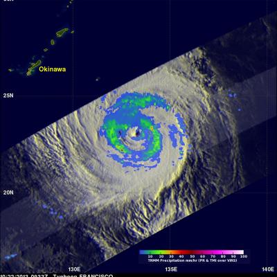
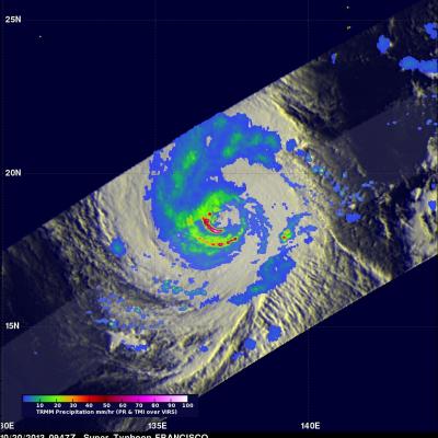
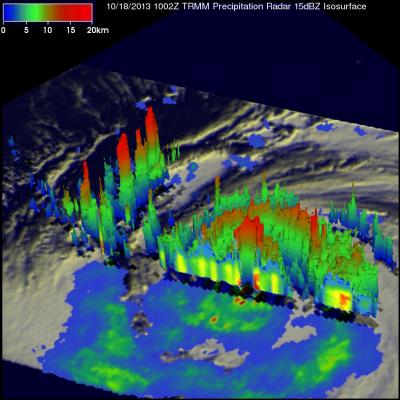
TRMM Sees Two Pacific Tropical Cyclones JacobAdmin Thu, 10/24/2013
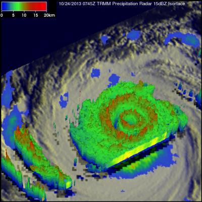
Tropical Storm Lekima Tropical Storm Francisco The TRMM satellite flew above the centers of two tropical cyclones in the western Pacific Ocean early this morning. The first orbit saw super typhoon LEKIMA at 0745 UTC and with the next orbit tropical storm FRANCISCO came into view at 0919 UTC. Lekima was located southeast of tropical storm Francisco over the open waters of the Pacific. Precipitation data from TRMM's Microwave Imager (TMI) and Precipitation Radar (PR) instuments are shown overlaid on infrared images from TRMM's Visible and InfraRed Scanner (VIRS). These rainfall analyses show the
Weaker Typhoon Francisco Seen By TRMM JacobAdmin Tue, 10/22/2013
Typhoon Francisco was headed toward the islands of southern Japan when the TRMM satellite had a good view on October 22, 2013 at 0933 UTC. Francisco was weakening and had estimated winds of less than 75kts (~86 mph) with this TRMM pass. An analysis derived from TRMM's Microwave Imager (TMI) and Precipitation Radar (PR) instruments is shown overlaid on an enhanced infrared image from TRMM's Visible and InfraRed Scanner (VIRS). This analysis showed that the most intense rain was falling at a rate of over 75mm/hr (~3 inches) in a location well to the southwest of Francisco's center of circulation
Super Typhoon Francisco Heads Toward Japan JacobAdmin Mon, 10/21/2013
Super typhoon Francisco is headed toward Japan as the country is still recovering from typhoon Wipha. The TRMM satellite flew above the western Pacific and caught a good view of super typhoon Francisco on October 20, 2013 at 0947 UTC. A precipitation analysis from TRMM's Microwave Imager (TMI) and Precipitation Radar (PR) instruments found that rain was falling at the extreme rate of over 207 mm/hr (~8.1 inches) in an area of violent storms southwest of Francisco's eye. TRMM's Precipitation Radar (PR) discovered radar reflectivity values of over 53dBZ in heavy precipitation south of Francisco

TRMM Monitors Super Typhoon Francisco

The sixth super typhoon of 2013 called Francisco developed in the Western Pacific Ocean on October 16, 2013. The image on the left was made from data collected as the TRMM satellite passed over on October 18, 2013 at 1002 UTC when super typhoon Francisco was located west-northwest of Guam. A rainfall analysis that used data from TRMM's Microwave Imager (TMI) and Precipitation Radar (PR) instruments is shown on the left overlaid on an enhanced infrared image from TRMM's Visible and InfraRed Scanner (VIRS). TRMM PR found that rain was falling at a rate of over 113 mm/hr (~4.5 inches) in powerful