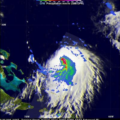
Hurricanes

<iframe width="490" height="276" src="https://www.youtube.com/embed/oiGzKmfOvkg?rel=0" frameborder="0" allowfullscreen></iframe>
As we enter the new year, take a look back at the snowstorms, tropical storms, typhoons, hurricanes and floods captured and analyzed by the Global Precipitation Measurement (GPM) mission from around the globe during 2015. 
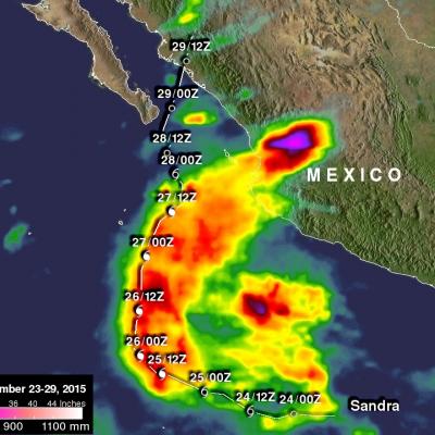
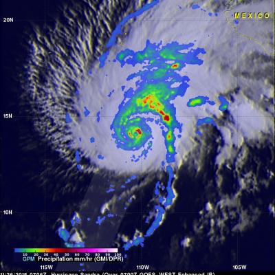
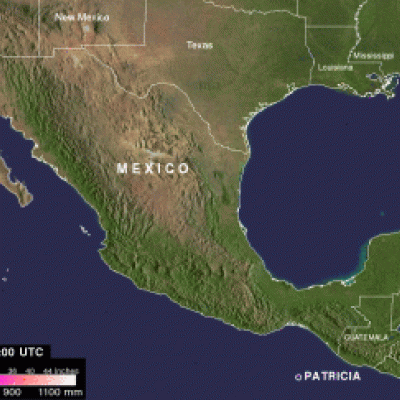
The complete list of storms by date and location are as follows: 1. New England Nor’easter – January 26 – New England, USA 2. Snowstorm – February 17 – Kentucky, Virginia and North Carolina, USA 3. Tornadic Thunderstorms in Midwest – March 25 – Oklahoma and Arkansas, USA 4. Typhoon Maysak – March 30 – Yap Islands, Southwest Pacific Ocean 5. Rain Accumulation from Cyclone...

NASA IMERG Data Measures Hurricane Sandra's Rainfall

Data from NASA's Integrated Multi-satellitE Retrievals for GPM (IMERG) were used to estimate the amount of rainfall that hurricane Sandra produced during the period from November 23-29, 2015. Sandra remained well off the Mexican coast during the most dangerous period from November 25-27, 2015 when Sandra was a powerful hurricane with sustained winds of up to 130 kts (150 mph). This analysis shows that much of Sandra's rainfall occurred over the open waters of the Eastern Pacific. This analysis indicates that moisture flowing from hurricane Sandra also caused heavy rainfall totals of over 700

Powerful Hurricane Sandra Viewed By GPM

The GPM core observatory satellite flew above hurricane Sandra on November 26, 2015 at 0706 UTC. Sandra had winds of 125 kts (144 mph) at that time making it a category three on the Saffir-Simpson hurricane wind scale. This means that Sandra is the latest major hurricane ever recorded in the eastern Pacific Ocean. Numerous powerful hurricanes were predicted in the eastern Pacific Ocean at the beginning of the hurricane season due to the development of the 2015 El Nino. Data captured by GPM's Microwave Imager (GMI) and Dual-Frequency Precipitation Radar (DPR) instruments shows rain falling at a

Patricia Remnants Combine With Storm System Over Texas

Patricia, the most powerful hurricane on record in the Western Hemisphere, quickly lost power as it moved over Mexico. Then an upper-level low pressure system and the remnants of hurricane Patricia combined to cause very heavy rain in Texas. On Sunday October 25, 2015 eastern Texas, Louisiana and Mississippi were also warned of flooding as extreme rainfall moved eastward along the Gulf Coast.
Hurricane Patricia Makes Landfall in Mexico
The eye of hurricane Patricia hit the Mexican coast on October 23, 2015 at approximately 6:15 PM CDT(2315 UTC)near Cuixmala, Mexico. The maximum winds at that time were estimated to be 143 kts (165 mph). Patricia is weakening rapidly but continued heavy rain is expected to cause flash floods and mudslides in the Mexican states of Nayarit, Jalisco, Colima, Michoacan and Guerrero through Saturday October 24, 2015. Over the weekend the remants of Patricia are also expected to add to the extreme rainfall in Texas. Rainfall from a stalled front that has been causing flooding in northern and central...

GPM Sees Patricia Becoming A Hurricane

During the night tropical storm Patricia became much better organized and was upgraded to a hurricane. The GPM core observatory satellite flew above the intensifying tropical cyclone on October 22, 2015 at 0401 UTC. Patricia was still a tropical storm with maximum sustained winds estimated at 55 kts (63 mph) at that time but rainfall derived from GPM's Microwave Imager (GMI) and Dual-Frequency Precipitation Radar (DPR) instruments showed that an eye was forming. The National Hurricane Center (NHC) 0400 AM CTD discussion said that, "... 37 GHz GPM image showed a cyan ring around the eye, which

GPM Checks on Cat 4 Hurricane Olaf

On October 19, 2015 Hurricane Olaf became the eighth category four hurricane in the busy 2015 Eastern Pacific hurricane season. The GPM core observatory satellite had a good look at the distribution of rainfall around powerful hurricane Olaf on October 20, 2015 at 0716 UTC. At that time Olaf had sustained winds estimated at over 130 kts (150 mph). GPM's Microwave Imager (GMI) and Dual-Frequency Precipitation Radar (DPR) measured the intensity of rainfall within the hurricane. GPM's GMI found rain falling at a rate of over 71.5 mm (2.8 inches) per hour in Olaf's eye wall. The DPR instrument

IMERG Measures Historic Rainfall With A Nor'easter and Joaquin

NASA's Integrated Multi-satellitE Retrievals for GPM (IMERG) data were used to estimate the historic amount of rain that fell during the past week in the Carolinas. A "fire hose" of moisture has been pumped into the Carolinas from hurricane Joaquin resulting in wide spread flooding. Over two feet of rain have been reported in South Carolina. This analysis indicated that major hurricane Joaquin also dropped over 700 mm (27.5 inches) in the Bahamas. Hurricane Joaquin has weakened from a category four hurricane in the Bahamas to a category one hurricane affecting Bermuda. Click here to see a

Joaquin Becomes a Hurricane, Could Impact the US East Coast

Joaquin, which became a tropical storm Monday evening (EDT) midway between the Bahamas and Bermuda, has now formed into a hurricane, the 3rd of the season--the difference is Joaqin could impact the US East Coast. GPM captured this image of Joaquin late yesterday afternoon at 21:39 UTC (5:39 pm EDT) on the 29th of September as Joaquin was moving very slowly towards the west-southwest about 400 miles east of the northwestern Bahamas. This first image shows rain rates derived from GPM's GMI microwave imager (outer swath) and DPR space-borne precipitation radar (inner swath) overlaid on IR data

Ignacio Expected To Pass Near Hawaii

Hurricane Ignacio is the latest tropical cyclone in this busy 2015 eastern Pacific hurricane season to pose potential danger for the Hawaiian Islands. Guillermo passed close to the north, Hilda curved to the south and Kilo's course was threatening before a course change moved it to the south of the islands. The Central Pacific Hurricane Center in Honolulu Hawaii predicts that Ignacio will still be a hurricane when it passes to the northeast of Hawaii in about five days. Rainfall associated with hurricane Ignacio was measured by the GPM core observatory satellite's Microwave Imager (GMI) on